Atlas van der Hagen
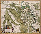
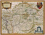
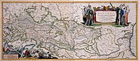
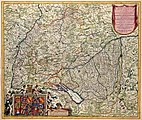
The Atlas Van der Hagen is a so-called composite atlas. This means that the term ‘atlas’ should not be interpreted in the modern sense of the word, as a ‘book of maps’, but taken in the wider sense: a collection of maps and topographical pictures, with additional portraits, pictures of animals and plants, mythological scenes, etc.
It is not exactly known who composed this atlas, but recent research regards the Amsterdam merchant and map collector Dirk van der Hagen as its compositor. Van der Hagen had brought together a considerable collection of drawings and prints and it seems that he choose the most beautiful ones to be colored by hand by the famous artist Dirk Jansz van Santen.
The atlas consists of four volumes bound in parchment:
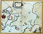
- I. World map, North and East Europe
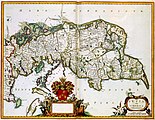
- II. United Kingdom, Netherlands, Belgium
- III. Spain, France, Italy, Greece
- IV. Asia, Africa, America, South Pole
These contain 446 maps and prints, in various formats, beautifully colored and decorated with gold: maps of Joan Blaeu and his father Willem Jansz Blaeu, Nicolaas Visscher II, Frederik de Wit and Jan Janssonius, and prints by Romeyn de Hooghe and others, all dating from the period up to 1689. This leads to the assumption that the atlas was composed around 1690. It has been held by the Koninklijke Bibliotheek since 1887, originating from the bequest of P.J.B.C. Robidé van der Aa.
In July 2015 the KB has donated all 446 images from this atlas into this category, from the source https://geheugen.delpher.nl/nl/geheugen/pages/collectie/Atlassen using the GLAMWiki toolset
| Dirk Jansz van Santen: Atlas van Dirk van der Hagen (volledig, collectie KB)
|
|||||||||||||||||||||
|---|---|---|---|---|---|---|---|---|---|---|---|---|---|---|---|---|---|---|---|---|---|
| Title |
Dutch: Atlas van der Hagen Atlas van Dirk van der Hagen (volledig, collectie KB) |
 | |||||||||||||||||||
| Object type |
atlas |
||||||||||||||||||||
| Language |
Dutch |
||||||||||||||||||||
| Date |
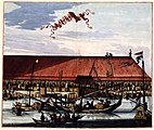
circa before 1690 |
||||||||||||||||||||
| Publication date |
circa |
||||||||||||||||||||
| Medium |
parchment |
||||||||||||||||||||
| Dimensions |
width: 54 cm (21.2 in) |
||||||||||||||||||||
| Collection |
|
||||||||||||||||||||
| Accession number |
KW 1049 B 10 [-13] (Koninklijke Bibliotheek) |
||||||||||||||||||||
| Place of creation |
Netherlands |
||||||||||||||||||||
| References | |||||||||||||||||||||

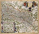
Volume 1 - World map, Northern and Eastern Europe edit
-
 Vol 1 - 001 - Arctico Norwegio Succia Dania Russia Polonia Ukraniae Hung-a Germania et Helvetia
 -
 Vol 1 - 002 - NOVISSIMA TOTIUS TERRARUM ORBIS TABULA -Wereldkaart in 2 hemisferen
 -
 Vol 1 - 003 - REGIONES SVB POLO ARCTICO
 -
 Vol 1 - 004 - SPITSBERGA
 -
 Vol 1 - 005 - NOVA ZEMBLA
 -
 Vol 1 - 006 - EUROPA delineata et recens edita
 -
 Vol 1 - 007 - NORVEGIA REGNUM, Vulgo NOR-RYKE
 -
 Vol 1 - 008 - Erobrung von MAERSTRANDT undt der starcken Vestung Carlsteyn mit beyligenden Schantzen undt Forten 1677.
 -
 Vol 1 - 009 - DIOECESIS STAVANGRIENSIS, & partes aliquot vincinae
 -
 Vol 1 - 010 - DIOECESIS BERGENSIS TABULA
 -
 Vol 1 - 011 - DIOECESIS TRVNDHEMIENSIS PARS AVSTRALIS
 -
 Vol 1 - 012 - FINMARCHIA
 -
 Vol 1 - 013 - REGNI DANIAE Novissima et Accuratissima TABULA
 -
 Vol 1 - 014 - INSULARUM DANICARUM ut ZEE-LANDIAE, FIONIAE LANGELANDIAE LALANDIAE FALSTRIAE, FEMBRIAE, MORIAE ... aliarumq- in Mare Balthico Sitar ... DESCRIPTIO
 -
 Vol 1 - 015 - IVTIA olim CIMBRICA CHERSONESVS
 -
 Vol 1 - 016 - DUCATVS SIESWICVM sive IVTIA AVSTRALIS
 -
 Vol 1 - 017 - LALANDIA FALSTRIA et MONA, INSULAE IN MARI BALTHICO
 -
 Vol 1 - 018 - ZEELANDIA INSULA Danicarum Maxima
 -
 Vol 1 - 019 - Accurata SCANIAE BLEKINCIAE et HALLANDIAE Descriptio
 -
 Vol 1 - 020 - De Belegeringe van Helsingburg
 -
 Vol 1 - 021 - Veroveringh van Cristiaans Stadt
 -
 Vol 1 - 022 - Tabula exactissima Regnorum SUECIAE et NORVEGIAE nec non MARIS UNIVERSI ORIENTALIS, Terrarumq- adjacentium summo studio ab
 -
 Vol 1 - 023 - REGNI SUECIAE Tabula Generalis, divisa in SUECIAE, GOTIAE .. REGNA FINNIAE, DUCATUM LAPPONIAM, LIVONIAM INGRIAMQ- et in omnes subiacentes provincias
 -
 Vol 1 - 024 - DVCATVS VPLANDIA
 -
 Vol 1 - 025 - NORLANDIAE et quibies CESTRIACIA et HELSINGICAE REGIONES
 -
 Vol 1 - 026 - LAPPONIA
 -
 Vol 1 - 027 - GOTHIA
 -
 Vol 1 - 028 - MAGNUS DVCATVS FINLANDIAE
 -
 Vol 1 - 029 - LIVONIA Vulgo Lyetland
 -
 Vol 1 - 031 - RVSSIAE vulgo MOSCOVIA, Pars Australis
 -
 Vol 1 - 032 - RVSSIAE Vulgo MOSCOVIA dictae, Pars Occidentalis
 -
 Vol 1 - 033 - RVSSIAE vulgo MOSCOVIA dictae, Partes Septentrionalis et Orientalis
 -
 Vol 1 - 035 - CRACOVIA POLONIAE URBS CELEBRIS AERI EXPRESSA
 -
 Vol 1 - 036 - INVICTO AUGUSTO IOANNI III REGI POLONIAE MAGNO DUCI LITHUANIAE, UKRAINAE, etc. PER INNUMEROS TRIUMPHOS, AD CORONATIONEM, DE TURCIS, TARTATRIS, COSACCIS, etc. VICTORI, ULTORI; REDUCI
 -
 Vol 1 - 037 - Tabula PRUSSIAE EXIMIA CURA CONSCRIPTA
 -
 Vol 1 - 038 - DANTZIG IN PLANO ANNO. 1687
 -
 Vol 1 - 039 - MAGNI DVCATVS LITHVANIAE, et Regionum Adiacentium exacta Descriptio ...
 -
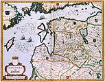
 Vol 1 - 040 - Delineatio Generalis CAMPORUM DESERTORUM vulgo UKRAINA, Cum adjacentibus Provinciis Bono publico erecta
 -
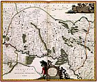
 Vol 1 - 041 - UKRAINAE PARS QVA POKUTIA Vulgo dictur
 -
 Vol 1 - 042 - UKRAINAE PARS QVA BARCLAVIA PALATINATUS Vulgo dicitur
 -
 Vol 1 - 043 - UKRAINAE PARS, QUA KIOVIA PALATINATUS Vulgo dicitur
 -
 Vol 1 - 044 - UKRAINAE PARS, quae PODOLIA PALATINATUS Vulgo dicitur
 -
 Vol 1 - 045 - TOTIUS REGNI HUNGARIAE et adjacentium Regionum TABULA A.o 1687 ob res bellicas inter Christianos et Turcas de novo correcta ac innummeris locis aucta
 -
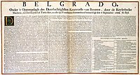 Vol 1 - 046 1- BELGRADO, Onder t Oppergesagh des Doorluchtighsten Keurvorsts van Beyeren, door de Keyserlycke Machten, met het Keyserlyk Turks Slot, en alle sijn Voorsteeden
 -
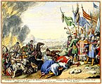
 Vol 1 - 046 - BELGRADO MET SYN SLOT EN VOOR STEEDEN STORMENDERHAND VEROVERT DOOR DE KEYSERLYKE MACHTEN DEN 6 SEPT. 1688
 -
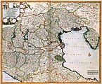
 Vol 1 - 047 - S. IMPERIUM ROMANO-GERMANICUM oder DEUTSCHLAND MIT SEINEN ANGRANTZENDEN KÖNIGREICHEN UND PROVINCIEN Neulich entworffen und theils gezeichnet durch IULIUM REICHELT Chur Pfaltz
 -
 Vol 1 - 048 - CIRCULI AUTRIACI Pars Septentrionalis in qua ARCHIDUCATUS AUSTRIAE ET DUCATUS STIRIAE accuratissime divisi oftenduntur PER
 -
 Vol 1 - 049 - VIENNENSE TERRITORIUM OB RES BELLICAS INTER CHRISTIANOS ET TURCAS NUPERRIME EDITUM
 -
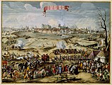
 Vol 1 - 050 - De belegering van Wenen door de Turken in 1683
 -
 Vol 1 - 051 - IOVI PROPITIO MARTI BIS ULTORI MDCLXXXIII LEOPOLDI I.D.G. GERM. IMP. DIV. AUG. FEL. NEC NON IOANNIS. III. D.G. POLON. REG. INVICTISS- ACTA PROPE OBSESSAM VIENNAM AUSTRIAE VERE HERÖICA
 -
 Vol 1 - 051 2A-Huldiging der Hongaren en Tyrannie der Rebellen Turken, en Tartaren = Hommage des Hungrois et Tirannie des Rebelles Turcqs et Tartares
 -
 Vol 1 - 051 2B-t Veroveren en ruineeren van Tabor, Leopold-stad en den Donauer pasbrug door de Turken = Prise de Tabor, Leopoldstat, et du pont sur le passage du Donau ruinees par les Turcqs
 -
 Vol 1 - 051 3A-Loopgraven, Batteryen, en Krijgsgewelt der Turken etc. voor Weenen = Approches Batteries et preparatifs de guerre des Turcs etc. devant Vienne
 -
 Vol 1 - 051 3B-Iver der Geestelyke en Wereltlyke in Weenen, int ruineeren en verbranden der Turkse werken, en Logementen
 -
 Vol 1 - 051 4A-Mynen Stormen etc. der Turken, Contramynen et uytvallen der beleegerden = Mines et assauts des Turcqs, Contremines et Sorties des Assieges
 -
 Vol 1 - 051 4B-Opening en slaen der Turken aen t Weener Wald = Ouverture du Grand Bois de Vienne et defaicte des Turqs
 -
 Vol 1 - 051 5A-Ontdeckte en vernietigde Myn der Turken onder de Keyserlycke Burgh = Mine des Turcqs sous la Cour Imperiale, decou- verte et defaicte
 -
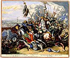
 Vol 1 - 051 5B-Bataille der Keyserse tegen de Turken int ont- setten van Weenen = Bataille des Imperiaux contre les Turqs pour lever le Siege de Vienne
 -
 Vol 1 - 051 6A - Veroveren der groote Standaert en Nederlaeg der Turken = Prise du grand Estendart et defaicte entiere des Turcqs
 -
 Vol 1 - 051 6B-Triumfante Intree van S.K.M. in de Tent des Grooten Vizirs = Entree Triumphante de sa M- Imp- dans la Tente du Grand Vizir
 -
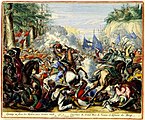
 Vol 1 - 051 7-Helde-Daden der Christenen, voor, in, en omtrent de Beleegering van WEENEN, Van den 1. July tot den 13. September 1683
 -
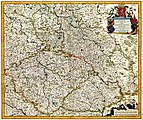 Vol 1 - 052 - REGNUM BOHEMIA, ANNEXAE PROVINCIAE, UT DUCATUS SILESIA, Marchionatus MORAVIA, et LUSATIA- quae sunt TERRAE HAEREDITARIAE IMPERATORIS
 -
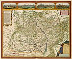
 Vol 1 - 053 - SILESIA DVCATVS
 -
 Vol 1 - 054 - MORAVIA NOVA ET POST OMNES PRIORES ACCURATIS- SIMA DELINEATIO
 -
 Vol 1 - 055 - TYROLIS COMITATVS
 -
 Vol 1 - 057 - CIRCULI SAXONIAE SUPERIORIS PARS MERIDIONALIS in qua sunt DUCATUS SAXONIAE, COMITUS MANSFELDIAE, ET VOITLANDIAE, LANDGRAVIAT THURINGIAE MARCHIONATUS MISNIAE
 -
 Vol 1 - 058 - THVRINGIA LANDGRAVIATVS
 -
 Vol 1 - 059 - MARCHIONATUS BRANDENBURGI ET DUCATUS POMERANIAE TABULA Qua est pars Septentrionalis CIRCULI SAXIONAE SUPERIORIS
 -
 Vol 1 - 060 - DUCATUS POMERANIAE Tabula Generalis, in qua sunt DUCATUS POMERANIAE, STETTINENSIS CASSUBIAE, VANDALIAE et BARDENSIS, PRINCIPATUS RUGIAE ac INSULAE, COMITATUS GUSKOVIENSIS
 -
 Vol 1 - 061 - VEROVERING van STETTIN
 -
 Vol 1 - 062 - RVGIA INSVLA AC DVCATVS
 -
 Vol 1 - 063 - CIRCULIS SAXIONIAE INFERIORIS in quo sunt DUCATUS HOLSATIAE, MEKLENBURG LAUWENBURGI, LUNEBURGI, BRUNSUIGI, BREMAE et FERDAE, COMITATUS DANNEBERGI ARCHIEPISCOPATUS MAEGDENBURGENSIS
 -
 Vol 1 - 064 - DUCATUS MEKLENBURGICUS in quo sunt DUCATUS VANDALIAE et MEKLENBURGI COMITATUS et EPISCOPATUS SWERINENSIS ROSTOCHIENSE et STARGARDIENSE DOMIN-I?
 -
 Vol 1 - 065 - De Belegeringh van Wismar
 -
 Vol 1 - 066 - HOLSATIAE TABULA GENERALIS in qua sunt DUCATUS HOLSATIAE, DITHMASIAE STORMARIAE et WAGRIAE
 -
 Vol 1 - 067 - NOBILISSIMI ALBIS FLUVII OSTIA, nec non HAMBURGENSE et alia Territoria adjacentia
 -
 Vol 1 - 068 - DUCATUS BREMAE & FERDAE Maximaeque partis FLUMINIS VISURGIS
 -
 Vol 1 - 069 - DVCATVS BRVNSVICENSIS fereq- LVNENBVRGENSIS, Cum adjacentibus Episcopatibus, Comit. Domin. Tec. DESCRIPTIO GEOGRAPHICA, per annos aliquot concinnata
 -
 Vol 1 - 070 - Nova totius WESTPHALIAE
 -
 Vol 1 - 071 - Het hooge school tot Linge
 -
 Vol 1 - 072 - COMITATVS BENTHEIM et STEINFVRT
 -
 Vol 1 - 073 1 - Celssissimo Potentissimo Invictissimoq- PRINCIPI FREDERICO GUILIELMO II D G MARCHIONI BRANDENBURGICO SRIELECTORI ac ARCHICAMERARIO etc Hanc Exactiismam CLIVIAE DUCATUS et MARCHIAE COMITATUS Tabulam
 -
 Vol 1 - 073 - TYPVS FRISIAE ORIENTALIS.
 -
 Vol 1 - 074 - Celssissimo Potentissimo Invictissimoq- PRINCIPI FREDERICO GUILIELMO II D G MARCHIONI BRANDENBURGICO SRIELECTORI ac ARCHICAMERARIO etc Hanc Exactiismam CLIVIAE DUCATUS et MARCHIAE COMITATUS Tabulam
 -
 Vol 1 - 075 - Illustrissimo Celsissmo Principi GUILIELMO HENRICO D.G. Arausionum Principi Domino suo Clementissimo Hanc COMITATUS MEURSENSIS et Annexarum Dinastiarum
 -
 Vol 1 - 076 - LEODIENSIS EPISCOPATUS in omnes SUBJACENTES PROVICIAS distincté divisus
 -
 Vol 1 - 077 - LEGIA sive LEODIVM vulgo LIEGE
 -
 Vol 1 - 078 - ARCHIEPISCOPATUS et ELECTORATUS COLONIENSIS maximaeque partes DUCATUM JULIACENSIS CLIVIENSIS, ET MONTENSIS aliaeque minores Ditiones infertae et adjacentes
 -
 Vol 1 - 080 - ARCHIEPISCOPATUS et ELECTORATUS TREVIRENSIS Novissima delineatio Exacte divisa in Omnes Suas PRAEFECTURAS in hac quoq- Tabula accurate describiturr EYFALIA TRACTUS
 -
 Vol 1 - 082 - TABULA GEOGRAPHICA QUA PARS MERIDIONALIS SIVE SUPERIOR RHENI MOSAE ET MOSELLE ac minores in eosdem influentes Fluvii nec non mediae partes ARCHIEPISCOPATUS
 -
 Vol 1 - 083 - TABULA GEOGRAPHICA QUA PARS SEPTENTRIONALIS SIVE INFERIOR RHENI, MOSAE, ET MOSSELAE, maximaeque partes VISURGIS, MOENI, AMASI, SCALDIS, ISALAE, et alia in eosdem influentia Flumina
 -
 Vol 1 - 084 - EXACTISSIMA PALATINATUS RHENI ac DUCATUS BIPONTINI TABULA, qua tam omnes eorundem Balliviatus subjacentes, quam aliae Ditiones insertiae et adjacentes distincté et peraccuraté ostenduntur
 -
 Vol 1 - 085 - CAPTUM PHILIPSBURGUM A.o 1676 9-17
 -
 Vol 1 - 086 - ARCHIEPISCOPATUS et ELECTORATUS MOGUNTINI et adjacentium Regionum, ut LANDGRAVIATUM HASSO DARMSTADIENSIS et RHENOFELDENSIS, COMITATUUM HANNOVIENSIS
 -
 Vol 1 - 087 - NASSOVIA Comitatus
 -
 Vol 1 - 088 - Novam Hanc TERRITORII FRANCOFVRTENSIS Tabulam ...
 -
 Vol 1 - 089 - HASSIA Landgraviatus
 -
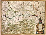
 Vol 1 - 090 - CIRCULUS FRANCONICUS in quo sunt EPISCOPATUS WURTZBURG, BAMBERG et AICHSTET. STATUS EQUITUM TEUTONICOR DUCATUS COBURGENSIS. MARCHIONATUS CULLEMBACH, et ONSPACH
 -
 Vol 1 - 091 - DANVBIVS, FLUVIUS EUROPAE MAXIMUS, A FONTIBVS AD OSTIA, Cum omnibus Flumnibus ab utroque latere, in ullum defluentibus.
 -
 Vol 1 - 092 - CIRCULUS SUEVICUS in quo sunt DUCATUS WIRTENBERGENSIS, MARCHIONATUS BADENSIS, & BURGOVIENSIS, COMITATUS OTTING, RECHBERG, KONIGSEK HOHENZOLERN, & FURSTENBERG
 -
 Vol 1 - 093 - Utriusque ALSATIAE, DUCATUS DUPONTII, et SPIRENSIS EPISCOPATUS Novissima Descriptio
 -
 Vol 1 - 094 - SUPERIORIS ALSATIAE nec non BRISIGAVIAE et SUNTGAVIAE GEOGRAPHICA TABULA, in qua subjacentia Territoria distincte ostenduntur, ex conatibus
 -
 Vol 1 - 095 - LANDGRAVIATUS ALSATIAE INFERIORIS Novissima Tabula, in qua simul MARCHIONATUS BADENSIS, ORTENAVIA Cateraq- tam Lotharingia quam alia Confina
 -
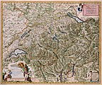 Vol 1 - 096 - Exactissima HELVETIAE RHAETIAE, VALESIA Caeterorumq- Confoedeatorum ut et finitimorum Populorum Regionum TABULA
 -
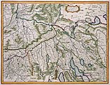 Vol 1 - 097 - ZVRICHGOW et Basiliensis provincia
 -
 Vol 1 - 098 - DAS WIFLISPVR- GERGOW
 -
 Vol 1 - 099 - ARGOW cum parte merid. ZVRICHGOW
 -
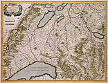
 Vol 1 - 100 - Alpinae seu Foederatae RHAETIAE SUBDITARUMQUE ei Terrarum nova descriptio


Volume 2 - United Kingdom, the Netherlands and Belgium edit
-
 Vol 2 - 001 - ANGLIAE SCOTIAE HIBERNIAE et GERMANIA INFERIOR Sive XVII Provinciarum
 -
 Vol 2 - 002 - ACCURATISSIMA ANGLIAE SCOTIAE ET Hiberniae TAB. De ... in lucem edita à CAROLO ALLARD
 -
 Vol 2 - 003 - BRITANNIA prout divisa fuit temporibus ANGLO-SAXONUM, praesertim durante illorum HEPTARCHIA
 -
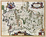
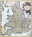 Vol 2 - 004 - A NEW MAP OF THE KINGDOME of ENGLAND, Representing the Princedome of WALES, and other PROVINCES, CITIES, MARKET TOWNS, with the ROADS from TOWN to TOWN
 -
 Vol 2 - 005 - CORNUBIA. sive CORNWALLIA
 -
 Vol 2 - 006 - DEVONIA vulgo DEVON-SHIRE
 -
 Vol 2 - 007 - VERTREK VAN S.K.H. NA ENGELAND, den 11. Nov. 1688. AENKOMST VAN S.K.H.D.P. VAN ORANGIE IN ENGELAND, den 15. en 16. Nov. 1688
 -
 Vol 2 - 008 - COMITATUS DORCESTRIA, sive DORSETTIA; Vulgo Anglice DORSET SHIRE
 -
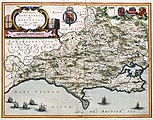
 Vol 2 - 010 - HANTONIA SIVE SOUTHANTONENSIS COMITATUS Vulgo HANT-SHIRE
 -
 Vol 2 - 011 - MONA INSULA Vulgo ANGLESEY. ; MONA INSULA Vulgo THE ISLE OF MAN. ; VECTIS INSULA Anglice THE ISLE WIGHT
 -
 Vol 2 - 012 - SURRIA Vernacule SURREY
 -
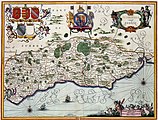 Vol 2 - 013 - SUTHSEXIA. Vernacule SUSSEX
 -
 Vol 2 - 014 - CANTIUM Vernacule KENT
 -
 Vol 2 - 015 - RECEPTIE VAN HARE K.H. M de PRINC. VAN ORANGIE. als koningin van gr- Britange = RECEPTION OF HER ROIAL HIGH. THE PRINCESSE OF ORANGE as queene of great Brittain
 -
 Vol 2 - 015 1 - RECEPTIE VAN HARE K.H. M de PRINC. VAN ORANGIE. als koningin van gr- Britange = RECEPTION OF HER ROIAL HIGH. THE PRINCESSE OF ORANGE as queene of great Brittain
 -
 Vol 2 - 016 - GLOCESTRIA DVCATUS; Vulgo GLOUCESTER SHIRE
 -
 Vol 2 - 017 - OXONIUM Comitatus Vulgo OXFORD SHIRE
 -
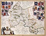
 Vol 2 - 018 - BUCKINGAMIAE COMITATVS cum BEDFORDDIENSI; vulgo BUCKINGAMSHIRE and BEDFORDSHIRE
 -
 Vol 2 - 019 - MIDDELSEXIAE, cum HERTFORDIAE, COMITATU- Midlesex & Hertford Shire-
 -
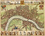 Vol 2 - 020 - Plattegrond van de stad Londen
 -
 Vol 2 - 020 1 - A New Mapp of the CITTYES of LONDON and WESTMINSTER with the BOROUGH of SOUTHWARK & all the SUBURBS
 -
 Vol 2 - 021 - Receptie van S.K.H. den Prince van Orange op zijn intrede tot London = THE Reception of His Royal Highnesse the Prince of Orange at his entring London
 -
 Vol 2 - 021 1 - Recepte van sijn S.K.H. den Heere Prince van Oranje op sijn intrede tot Londen -Franse en Nederlandse tekst
 -
 Vol 2 - 022 - WILHELMI III. D.G. MAGNAE BRITANNIAE REGIS. UT ET MAGNATUM PROCERUMQUE IN ANGLIA CONCESSUS
 -
 Vol 2 - 022 1 - EXPLICATION of the NummerS On the Ground in the Session of the HOUSE OF LORDS ... = AFBEELDINGE Der Sittinge van het HOOGERHUYS
 -
 Vol 2 - 023 - Alle de bijsondere en particuliere Ceremonien, geschied in en omtrent de Krooning WILLIAM de III. en MARIA de II
 -
 Vol 2 - 023 1 - Alle de bijsondere en particuliere Ceremonien, geschied in en omtrent de Krooning WILLIAM de III. en MARIA de II
 -
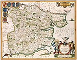 Vol 2 - 024 - ESSEXIAE DESCRIPTIO. The DESCRIPTION of ESSEX
 -
 Vol 2 - 025 - SVFFOLCIA. Vernacule SVFFOLKE
 -
 Vol 2 - 026 - NORTFOLCIA; NORTFOLKE
 -
 Vol 2 - 027 - LEICESTRENSES COMITATVS cum RVTLANDIAE Vulgo Leicester & Rutland Shire
 -
 Vol 2 - 028 - LINCOLNIA COMITATVS Anglis LYNCOLNE SHIRE
 -
 Vol 2 - 029 - WIGORNIENSIS Comitatus et Comitatus WARWICENSIS; nec non COVENTRAE, LIBERTAS. WORCESTER, WARWIK SHIRE and THE LIBERTY OF CONVENTRE
 -
 Vol 2 - 030 - CESTRIA COMITATVS PALATINVS
 -
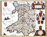 Vol 2 - 031 - WALLIA PRINCIPATUS Vulgo WALES
 -
 Vol 2 - 032 - MONVMETHENSIS COMITATVS. Vernacule MONMOVTH SHIRE
 -
 Vol 2 - 033 - DVCATVS EBORACENSIS Anglice YORKSHIRE
 -
 Vol 2 - 034 - EPISCOPATVS DVNELMENSIS Vulgo The Bishoprike of DVRHAM
 -
 Vol 2 - 035 - LANCASTRIA PALATINATUS Anglis LANCASTER et Lancas shire
 -
 Vol 2 - 036 - CVMBRIA Vulgo CUMBERLAND
 -
 Vol 2 - 037 - COMITATUS NORTHUMBRIA NORTHUMBERLAND
 -
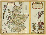 Vol 2 - 038 - SCOTIA REGNUM cum insulis adjacentibus
 -
 Vol 2 - 039 - LOTHIAN and LINLITQVO
 -
 Vol 2 - 040 - DStadt Edenburgh
 -
 Vol 2 - 041 - LIDALIA vel LIDISDALIA REGIO LIDISDAIL
 -
 Vol 2 - 042 - GALLOVIDIA vernacule GALLOWAY
 -
 Vol 2 - 043 - COILA PROVINCIA THE PROVINCE OF KYLE
 -
 Vol 2 - 044 - LEVINIA VICECOMITATVS. The Province of LENNOX, called the Shyre of Dun-Britton
 -
 Vol 2 - 045 - A Description of the two Shyres ABERDENE and BANF, With such Countreys and Provinces as ar comprehended under them
 -
 Vol 2 - 046 - LORNA, KNAPDALIA, CANTIRE, IURA, ILA, GLOTA, et BUTHE INSULAE
 -
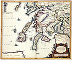
 Vol 2 - 047 - EXTIMAE SCOTIAE pars Septentrionalis, in qua Provinciae ROSSIA, SUTHERLANDIAE, CATHENESIA, et STRATH-NAVERNIAE
 -
 Vol 2 - 048 - HIBERNIAE REGNUM tam in praecipuas ULTONIAE, CONNACIAE, LAGENIAE, et MOMONIAE, quam in minores earundem Provincias, et Ditiones subjacentes peraccuraté divisum
 -
 Vol 2 - 049 - PROVINCIA VLITONIA The PROVINCIE of ULSTER
 -
 Vol 2 - 050 - PROVINCIA COMMACHITIAE The PROVINCE of CONNAVGT
 -
 Vol 2 - 051 - COMITATVS LAGENIAE The COVNTIE of LEINSTER
 -
 Vol 2 - 052 - Twee scenes- -1- VLUGT VAN JACOB DE II uyt Ierland naar Vrankrijk, den 12 Iuly 1690 -2- OVERWINNING VAN KON. WILLEM DE III. door het volkomen slaan van Jacob de II. in Ierland den 11 Iuly 1690
 -
 Vol 2 - 052 1 - Overwinning van Zijn Koninglijke Majesteyt WILHELM de III. Aan de Rivier Boyne in IERLAND behaald, den 11 July 1690
 -
 Vol 2 - 053 - PROVINCIA MOMONIA The PROVINCE of MOVNSTER
 -
 Vol 2 - 054 - GERMANIA INFERIOR, Sivè XVII PROVINCIARUM GEOGRAPHICAE GENERALES ut et PARTICULARES TABULAE = KAERT-BOECK VAN DE XVII NEDERLANDTSCHE PROVINCIEN -titlepage
 -
 Vol 2 - 055 - Novissima et accuratissima XVII PROVINCIARUM GERMANIAE INFERIORIS Delineatio
 -
 Vol 2 - 056 - BELGII REGII TABULA in qua omnes Provinciae ab Hispanis ad annum 1684 possessae, nec non tam a Rege Galliae quam Batavis acquisitae, accuratissime
 -
 Vol 2 - 057 - TABULA DUCATUS BRABANTIAE continens MARCHIONATUM SACRI IMPERII et DOMINIUM MECHLINIENSE de novo accuratè emendata
 -
 Vol 2 - 058 - PARS MERIDIONALIS BRABANTIAE continens DOMINIUM MECHLINIENSE Ducatum Arschotanum
 -
 Vol 2 - 059 - BRABANTIAE PARS-SEPTENTRIONALIS
 -
 Vol 2 - 060 - MARCHIONATUS SACRI ROMANI IMPERII
 -
 Vol 2 - 061 - BRABANTIAE pars Orientalis continens
 -
 Vol 2 - 062 - LIMBURGI Ducatus Comitatus VALCKENBURGI Nova Descriptio
 -
 Vol 2 - 063 - DUCATUS LUTZENBURGI Novissima et accuratissima DELINEATIO
 -
 Vol 2 - 064 - LUXEMBURGUM DUCAT- COGNOM- METROPOL- µ CHIMACENS- PRINC- STREN- DEF- REG- GALLIAE ARMIS VERO OCCUP- IV IUNII A.o M.DC.LXXXIIII
 -
 Vol 2 - 065 - FLANDRIAE COMITATUS Accuratissima Descriptio, edita
 -
 Vol 2 - 066 - Pars FLANDRIAE occiden continens
 -
 Vol 2 - 067 - Perfecte Kaerte, van t BERGER EN BROECBORGER AMBACHT, mitsgaders de Wateringen ende de Vier Dycken, waer in oock vertoont wert de Belegeringe van Grevelingen
 -
 Vol 2 - 068 - FLANDRIAE Partes duae, quarum altera PROPRIETARIA, altera IMPERIALIS vulgo dicitur
 -
 Vol 2 - 069 - NIEWE KAERTE VAN T LANDT VAN WAES ende HULSTER AMBACHT, vertoonende oock de Stroomen van de Ooster ende Wester SCHELDE
 -
 Vol 2 - 070 - Pars FLANDRIAE Orientalis FRANCONATUM INSULAM CADSANT CIVITATESQ. GANDAVUM OOSTENDAM BRUGAM SLUSAM etc- Continens
 -
 Vol 2 - 071 - t Meerderdeel van t OOST-VRYE in VLAENDEREN vertoonende doprechte gelegenh- der Landen, Fortressen, Schansen ende de nieuw bedijckte Polders
 -
 Vol 2 - 072 - FLANDRIA GALLICA Continens Castellanias Insulensem, Duacensem, Orchianensem, Civitatem Dominiumq- Tornacense
 -
 Vol 2 - 073 - GEOGRAPHICA ARTESIAE COMITATUS TABULA,
 -
 Vol 2 - 074 - COMITATUS HANNONIAE et ARCHIEPISCOPATUS CAMERACENSIS TABULA
 -
 Vol 2 - 075 - VILLA ANGIANA Vulgo HET PERC VAN ANGUIEN
 -
 Vol 2 - 075 1 - LE PARC D ANGUIEN = HET PERK VAN ANGUIEN
 -
 Vol 2 - 075 2 - ANGUIEN MET SYN OMLEGGENDE LANDEN EN STEDEN
 -
 Vol 2 - 075 3 - PLAN DU PARC DANGUIEN
 -
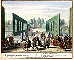
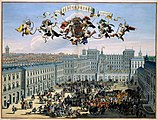
 Vol 2 - 075 4 - Aangezicht van de triomfboog bij de ingang van het park
 -
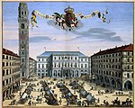
 Vol 2 - 075 5 - Aangezicht op het grote paviljoen in het centrum van het park
 -
 Vol 2 - 075 6 - Uitzicht vanuit de Laan van Essenbossen op het paviljoen
 -
 Vol 2 - 075 7 - Aangezicht op de berg van Parnas
 -
 Vol 2 - 075 8 - Uitzicht vanuit de Triomfboog op la Motte
 -
 Vol 2 - 075 9 - Uitzicht vanaf de fonteingrotten op de triomfboog
 -
 Vol 2 - 075 10 - Uitzicht vanaf de bloemhof op de grote ronde trap en in haar verlengde de triomfboog
 -
 Vol 2 - 075 11 - Het labyrinth oft doolhof met de schoone fonteyn van Amphitrite = Le labyrinthe avec la magnifique fontaine d Amphitriae
 -
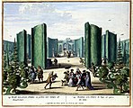 Vol 2 - 075 12 - Rondt net groene schutten en perken met naintjes oft dwergboomtjes = Rondeau avec clotures de haye et parcs des nains
 -
 Vol 2 - 075 13 - Aangezicht op de- Orangien Hoff met de marmere fonteyn van de drie gratien
 -
 Vol 2 - 075 14 - Aangezicht op het pavilioen van Samson en het meer van- sijn Hoogheyt
 -
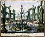 Vol 2 - 075 15 - Fonteyn en colise van groente = Fontaine et colise de Verdure
 -
 Vol 2 - 075 16 - Uitzicht op- Moestuinen
 -
 Vol 2 - 075 17 - Uitzicht op het- Groot rond met de bouteveue op den berg
 -
 Vol 2 - 075 18 - KORTE BESCHRYVINGE Van het seer Vermaarde en Vermakelijke PERK VAN Enguien Gelegen in t GRAAFSCHAP HENEGOUWEN
 -
 Vol 2 - 076 - COMITATUS NAMURCI Emendata Delineatio Nuperrimè in lucem
 -
 Vol 2 - 077 - MECHLINIA DOMINIUM et AERSCHOT DUCATUS
 -
 Vol 2 - 078 - TETRACHIA DUCATUS GELDRIAE RUREMONDANA sive HISPANICA
 -
 Vol 2 - 079 - BELGIUM FOEDERATUM emendata auctum et novissima editum
 -
 Vol 2 - 080 - DUCATUS GELDRIA et ZUTPHANIA Comitatus
 -
 Vol 2 - 081 - TETRACHIA DUCATUS GELDRIAE NEOMAGENSIS
 -
 Vol 2 - 082 - Novissima COMITATUS ZUTPHANIAE Totiusq- Fluminis DESCRIPTIO
 -
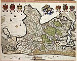
 Vol 2 - 083 - COMITATUS HOLLANDIAE TABULA PLURIBUS LOCIS RECENS EMENDATA A NICOLAO VISSCHER
 -
 Vol 2 - 084 - HOLLANDIAE PARS MERIDIONALIOR, vulgo ZUID-HOLLAND
 -
 Vol 2 - 085 - DE STAT DORDRECHT met de Aenpalende Landen als Out Dubbeldam, Den Zuyt en Noort- polder, Den Alloysen of Boven pol- der, Den Polder van Wieldrecht
 -
 Vol 2 - 086 - DELFLANDIA, SCHIELANDIA et circumjacentes Insulae ut VOONA, OVERFLACKEA, GOEREA, YSELMONDA et aliae
 -
 Vol 2 - 087 - TABULA ROTERODAMI NOVISSIMA
 -
 Vol 2 - 088 - RHENOLANDIA, AMSTELANDIA Et Circumjacentia aliquot Territoria, cum Aggeribus omnibus Terminisq- suis, Accurate et distincte edita
 -
 Vol 2 - 089 - LUGDINI BATAVORUM VULGO LEYDEN SIC ULTIMO AMPLIFICAM DELINEATIO
 -
 Vol 2 - 090 - SWANENBURCH Gemeenlants Huys van Rynlant gelegen tussen Haerlem ende Amsterdam
 -
 Vol 2 - 091 - EXACTISSIMA AMSTELODAMI VETERIS ET NOVISSIMA DELINEATO PER F. DE WIT
 -
 Vol 2 - 092 - BELEGERINGE DER STADT NAERDEN Zijnde de Eerste overwinninge die zijn Konincklijcke Hoogheyt de Heer Prinse van Oranjen heeft gedaen verovert
 -
 Vol 2 - 093 - T HOOGH-HEEMRAETSCHAP VAN DE UYTWATERENDE SLUYSEN IN KENNEMERLANT ENDE WEST-FRIESLANTT
 -
 Vol 2 - 094 - COMITATVS ZELANDIAE Novissima Delineatio per
 -
 Vol 2 - 095 - T Eylandt Walcheren is groot 43242 Gemeten 128 1-2 Roed
 -
 Vol 2 - 096 - ULTRAIECTINI DOMINI TABULA Multo aliis auctior et correctior
 -
 Vol 2 - 097 - DOMINII FRISIAE TABULA, inter FLEVUM et LAVICAM
 -
 Vol 2 - 099 - GRONINGAE ET OMELANDIAE DOMINIUM = DE PROVINCIE VAN STADT EN LANDE
 -
 Vol 2 - 100 - Quartae Partis BRABANTIAE seu Ditionis SILVAE DUCIS Accuratissima DELINEATIO


Volume 3 - Spain, France, Italy, Greece edit
-
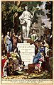
 Vol 3 - 001 - HISPANIAE GALLIAE ITALIAE et GRAECIAE -titelblad
 -
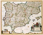 Vol 3 - 002 - HISPANIAE ET PORTUGALIAE REGNA
 -
 Vol 3 - 003 - VTRIVSQUE CASTELLAE nova descriptio
 -
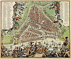
 Vol 3 - 004 - Aangezicht op- MADRID
 -
 Vol 3 - 005 - De Koning komt uyt zijn koets en knielt voor het H- Sacram- buyten Madrid
 -
 Vol 3 - 006 - LEGIONIS REGNVM et ASTVRIARUM PRINCIPATVS
 -
 Vol 3 - 007 - GALLAECIA REGNVM
 -
 Vol 3 - 008 - BISCAIA, ALAVA, et GVIPVSCOA CANTABRIAE VETERIS PARTES
 -
 Vol 3 - 009 - ANDALVZIA continens SEVILLAM et CORDVBAM
 -
 Vol 3 - 010 - INSULA CADITANA, Vulgo ISLA DE CADIZ
 -
 Vol 3 - 011 - GRANATA ET MVRCIA REGNA
 -
 Vol 3 - 012 - ARRAGONIA REGNVM
 -
 Vol 3 - 013 - Accuratissima PRINCIPATUS CATALONIAE et COMITATUUM RUSCINONIS et CERRETANIAE DESCRIPTIO
 -
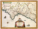 Vol 3 - 014 - VALENTIA REGNVM Contestani, Ptol., Edentani, Plin
 -
 Vol 3 - 015 - INSVLAE BALEARIDES et PYTIVSAE
 -
 Vol 3 - 016 - NAVARRA REGNVM
 -
 Vol 3 - 017 - PORTUGALLIAE et ALGARBIAE REGNA
 -
 Vol 3 - 018 - INSULAE ACORES
 -
 Vol 3 - 019 - GALLIAE seu FRANCIAE TABULA, qua omnes Provinciae, Viae angiarae et aliae res notatu dignae distincté et accuraté ostenduntur,
 -
 Vol 3 - 020 - LE GOVVERNEMENT DE LISLE DE FRANCE
 -
 Vol 3 - 021 - LUTETIA PARISIORUM Vulgo PARIS
 -
 Vol 3 - 022 - Marche du Roy accompagné des ses gardes passant sur le pont neuf et allant au Palais
 -
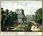
 Vol 3 - 023 - Veue et perspective du Chateau et Jardin de Versailles, comme il est apresant
 -
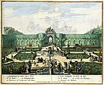
 Vol 3 - 024 - Les Cours Auenues et Ecuries de Versailles 1683
 -
 Vol 3 - 025 - Le Trianon de Versailles 1684
 -
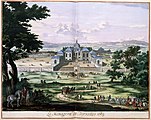 Vol 3 - 026 - La Ménagerie de Versailles 1683
 -
 Vol 3 - 027 - COMITATVS BELLOVACVM Vernacule BEAVVAIS
 -
 Vol 3 - 028 - CHAMPAGNE latine CAMPANIA, COMITATVS
 -
 Vol 3 - 029 - DIOECESE de RHEIMS et le païs de RETHEL
 -
 Vol 3 - 030 - NOVA PICARDIAE TABULA
 -
 Vol 3 - 031 - COMITATVVM BOLONIAE et GVINES DESCRIPTIO
 -
 Vol 3 - 032 - LE GOUVERNEMENT DE CALAIS, & PAIS, RECONQUIS
 -
 Vol 3 - 033 - NORMANDIA DVCATVS
 -
 Vol 3 - 034 - DUCHE de BRETAIGNE
 -
 Vol 3 - 035 - GOUVERNEMENT GENERAL DV PAYS ORLEANOIS
 -
 Vol 3 - 036 - PICTAVIAE DVCATVS DESCRIPTIO Vulgo LE PAIS DE POICTONS
 -
 Vol 3 - 037 - XAINTONGE avec LE PAYS DAVLNIS, LE BROVAGEAIS, TERRE DARVERT, &c
 -
 Vol 3 - 038 - BORBON- TVM DVCATVS BOURBON- NOIS
 -
 Vol 3 - 039 - GOVVERNEMENT DE LA GVIENNE & GASCOGNE
 -
 Vol 3 - 040 - LANGVEDOC
 -
 Vol 3 - 041 - LA PRINCIPAVTÉ DORANGE et COMTAT de VENAISSIN
 -
 Vol 3 - 042 - PROVINCIA ... PROVENCE
 -
 Vol 3 - 043 - NOVA et accurata Descriptio DELPHINATVS vulgo DAVPHINÉ
 -
 Vol 3 - 044 - BVRGVNDIA DVCATVS
 -
 Vol 3 - 045 - BURGUNDIA COMITATUS. Vulgo La FRANCHECOMTÉ
 -
 Vol 3 - 046 - Nova & Accurata delineatio Geographica EPISCOPATVS METENSIS Quo ad Iurisdictionem temporalem
 -
 Vol 3 - 047 - GENERALIS LOTHARINGIA DUCATUS TABULA, qua accuratissimé ostenduntur DUCATUS LOTHARINGIAE PROPRIAE ET BARRENSIS
 -
 Vol 3 - 048 - COMITATVS RUSCINONIS, Vulgo ROUSSILLON in quo EPISCOPATVS HELENENSIS, Gallieè EVESCHÉ ou de PERPIGNAN
 -
 Vol 3 - 049 - TOTIUS ITALIAE TABULA
 -
 Vol 3 - 050 - TABVLA Generalis SAUBAVDIAE
 -
 Vol 3 - 051 - ARX ET OPPIDUM MONTISMELIANI
 -
 Vol 3 - 052 - DVCATVS CHABLASIVS ET LACVS LEMENVS Cum Regionibus adjacentibus
 -
 Vol 3 - 053 - PEDEMONTIVM Et reliquae Ditionesssss Italiae REGIAE CELSITVDINI SABAVDICAE Subditae Cum Regionibus adjacentibus
 -
 Vol 3 - 054 - AVGUSTAE TAVRINORVM PROSPECTUS
 -
 Vol 3 - 055 - PROSPECTVS PLATAE VETERIS ANTE CASTRVM
 -
 Vol 3 - 056 - PLATEA REGIA AVGTAVR
 -
 Vol 3 - 057 - PALATIUM URBANUM CUMFORO OLITORIO
 -
 Vol 3 - 058 - REGIAE VENATIONIS AEDIUM Prospectus
 -
 Vol 3 - 059 - SIGNORIA di VERCELLI
 -
 Vol 3 - 060 - CITTA DIE VERCELLI
 -
 Vol 3 - 061 - LIGVRIA, Stato della Republica di GENOVA
 -
 Vol 3 - 062 - Stadsprofiel van- GENOA
 -
 Vol 3 - 063 - STATO DI MILANO
 -
 Vol 3 - 064 - DVCATO DI MANTOVA
 -
 Vol 3 - 065 - DVCATO di PARMA et di PIACENZA
 -
 Vol 3 - 066 - DVCATO DI MODENA REGIO ET CARPI , Col Dominio della Carsagnana
 -
 Vol 3 - 067 - Accuratissima DOMINII VENETI IN ITALIA DUCATUS PARMAE MODENAE REGII ET MANTUAE EPISCOPATUSSSS- TRIDENTINI Tabula quae est LOMBARDIA INFERIOR
 -
 Vol 3 - 068 - Stadsprofiel van- VENETIA
 -
 Vol 3 - 069 - TERRITORIO DI VICENZA
 -
 Vol 3 - 070 - TERRITORIO DI PAVIA, LODI, NOVARRA, TORTONA, ALLESSANDRIAAA et altri vicini dello Stato di Milano
 -
 Vol 3 - 071 - ISTRIA olim IAPIDIA
 -
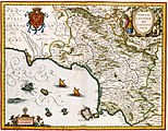
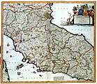 Vol 3 - 072 - STATUS ECCLESIASTICUS et MAGNUS DUCATUS THOSCANAE
 -
 Vol 3 - 073 - DVCATO DI FERRARA
 -
 Vol 3 - 074 - TERRITORIO DI BOLOGNA
 -
 Vol 3 - 075 - CAMPAGNA DI ROMA olim LATIVM- TVSCIA SVBVRBICARIA et in ea PATRIMONIVM S. PETRI; nec non SABINA
 -
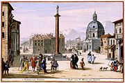
 Vol 3 - 076 - Stadsprofiel van- ROMA
 -
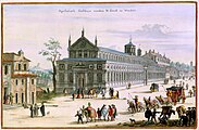
 Vol 3 - 077 1 - VOORNAAMSTE GEBOUWEN Vande Tegenwoordige STADT ROMEN
 -
 Vol 3 - 077 2 - Pausselyk Paleis genaamt Vaticaan
 -
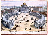
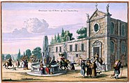
 Vol 3 - 077 3 - Het plein en de kerk van Sint Pieter
 -
 Vol 3 - 077 4 - Pausselyk Paleis op den Hengsten-Berg of Monte Cavallo
 -
 Vol 3 - 077 5 - Gezicht op de kolom van Trajanus en de kerk Sancto Maria van Loretto
 -
 Vol 3 - 077 6 - Apostolisch Gasthuys vanden H. Geest in Windels
 -
 Vol 3 - 077 7 - Paleis en Kerk van St. Andries vanden dale
 -
 Vol 3 - 077 8 - Overvaart van St. Pieter op den Gouden-Berg
 -
 Vol 3 - 078 - DOMINIO FIOREN- TINO
 -
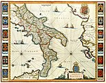 Vol 3 - 079 - REGNO DI NAPOLI
 -
 Vol 3 - 080 - TERRA DI LAVORNO olim CAMPANIA FELIX
 -
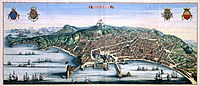 Vol 3 - 081 - Stadsprofiel van- NAPOLI
 -
 Vol 3 - 082 - INSULAE TREMITANAE, olim DIOMEDEAE dictae
 -
 Vol 3 - 083 - Caarte vande GOLF VAN VENETIEN Waar in vertoont wert de Zeekusten van Italien Dalmatien en Griekenlant
 -
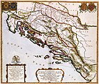 Vol 3 - 084 - ILIYRICVM HODIERNVM, Quod Scriptores communiter SCLAVONIAM, Itali SCHIAVONIAM nuncupare solent, in Dalmatiam, Croatiam, Bosnam, et Slavoniam
 -
 Vol 3 - 085 - ISCHIA Isola , olim AENARIA
 -
 Vol 3 - 086 - REGNUM SICILIAE Cum circumjacentibus REGNIS et INSULIS
 -
 Vol 3 - 087 - INSULARUM MELITAE Vulgo MALTAE et GOZAE
 -
 Vol 3 - 088 - Exactissima totius ARCHIPELACHI nec non GRAECIAE TABULA in qua omnes subjacentes Regiones et Insulae distincte ostenduntur
 -
 Vol 3 - 089 - City view on CHIOS
 -
 Vol 3 - 090 - MACEDONIA ALEXANDRI M. PATRRIA Illustris
 -
 Vol 3 - 091 - EPIRUS hodie vulgo ALBANIA
 -
 Vol 3 - 092 - DE STADT KORFU eertyts KORCYRA in t Verschiet
 -
 Vol 3 - 093 - ACHALIAE Noua & accurata DESCRIPTIO
 -
 Vol 3 - 094 - THESSALIAE accurata DESCRIPTIO
 -
 Vol 3 - 095 - PELOPON- NESVS sive MOREA
 -
 Vol 3 - 096 - PELOPONNESUS hodie MOREA Deo favente et Victoriosiss- Sereniss- Reipublicae Venetae armis plurimé Christianitati subacta
 -
 Vol 3 - 097 1 - VEROVERING VAN NAPOLI DI ROMANIA ARGOS TERES CORINTH- et NEVENS DE VICTORIE DER s.r. OP DE TURCKE
 -
 Vol 3 - 097 2 - VEROVERING VAN NAPOLI DI ROMANIA ARGOS TERES CORINTH- et NEVENS DE VICTORIE DER s.r. OP DE TURCKE
 -
 Vol 3 - 098 1 - Stadsprofiel van- CANDIA
 -
 Vol 3 - 098 2 - INSULA CANDIA olim CRETA
 -
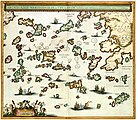 Vol 3 - 099 - ARCHIPELAGI MERIDIONALIS, seu CYCLADVM Insularum accurata DELINEATIO
 -
 Vol 3 - 100 - INSVLARVM ARCHIPELAGI SEPTENTRIONALIS seu MARIS AEGAEJ Accurata Delineatio


Volume 4 - Asia, Africa, America, South Pole edit
-
 Vol 4 - 001 - Titelblad- ASIAE - NOVA ATLAS SINENSIS A ---w-en-Martino Martini-Martino Martini-- O Soc. Iesu DESCRIPTVS ET SERENISSIMO ARCHIDVCI LEOPOLDO GVILIELMO AVSTRIACO DEDICATVS
 -
 Vol 4 - 002 - ASIAE NOVA DELINEATIO
 -
 Vol 4 - 003 - TVRCICVM IMPERIVM
 -
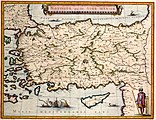 Vol 4 - 004 - NATOLIA, quae olim ASIA MINOR
 -
 Vol 4 - 005 - Panorama van- SMIRNE
 -
 Vol 4 - 006 - SYRIAE Sive SORIAE Nova et Accurata descriptio
 -
 Vol 4 - 007 - CYPRVS INSVLA
 -
 Vol 4 - 008 - TERRA SANCTAE SIVE PROMISSIONIS, olim PALESTINA
 -
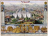
 Vol 4 - 009 - Panorama van- IERUSALEM
 -
 Vol 4 - 010 - IERUSALEM EN SYN TEMPEL
 -
 Vol 4 - 011 - DE Stadt IERUSALEM zoo t Hedendaeghs Bevonden wordt
 -
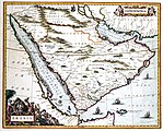 Vol 4 - 012 - ARABIA
 -
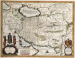 Vol 4 - 013 - PERSIA Sive SOPHORVM REGNVM
 -
 Vol 4 - 014 - MAGNI MOGOLIS IMPERIVM
 -
 Vol 4 - 015 - t Hof vanden grooten Mogol
 -
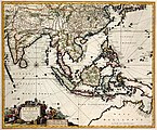 Vol 4 - 016 - INDIAE ORIENTALIS, nec non INSULARUM ADIACENTIUM
 -
 Vol 4 - 017 - Landt-caert vande Cust van MALABAER, MADURA en CORMENDEL
 -
 Vol 4 - 018 - OVER-WINNINGH van de Stadt COTCHIN op de Kust van MALLABAER
 -
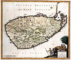 Vol 4 - 019 - INSULA CEILON olim TAPROBANA Incolis TENARISIN et LANKAWN
 -
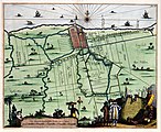 Vol 4 - 020 - Landt Caerte van BATAVIA met Haer onder hoorende Forten
 -
 Vol 4 - 021 - DE NIEUWE POORT
 -
 Vol 4 - 022 - de TYGERS-GRAFT op BATAVIA
 -
 Vol 4 - 023 - De KRUYS KERCK op BATAVIA
 -
 Vol 4 - 024 - RAET of STADTHUYS
 -
 Vol 4 - 025 - SPINHUYS
 -
 Vol 4 - 026 - T WEESHUYS op BATAVIA
 -
 Vol 4 - 027 - Het SLACHT ofte VLEES HAL op BATATVIA
 -
 Vol 4 - 028 - VIS MARKT op BATAVIA
 -
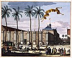
 Vol 4 - 029 - GOEVERNUERS HUYS BINNENT KASTEEL
 -
 Vol 4 - 030 - VICTORIEN DER NEDERL. GEOCT. O.C. COMPAGNIE HET KONINKRYCK VAN MACASSER Door den Ed. Ed. Heer C. Speelman
 -
 Vol 4 - 031 - MOLVCCAE INSVLA CELEBERRIMAE
 -
 Vol 4 - 032 - TARTARIA sive MAGNICHAMI IMPERIVM
 -
 Vol 4 - 033 - IMPERII SINARVM NOVA DESCRIPTO
 -
 Vol 4 - 034 - PECHELI SIVE PEKING IMPERII SINARVM PROVINCIA PRIMA
 -
 Vol 4 - 035 1 - PEKING
 -
 Vol 4 - 035 2 - Interior aulae Imperatoriae facies T KEYSERS HOF VAN BINNEN
 -
 Vol 4 - 036 - The Station used by the great Mandaryns Staetsie der groote Mandarijns
 -
 Vol 4 - 037 - Xansi (Shanxi)
 -
 Vol 4 - 038 - XENSI. IMPERII SINARVM PROVINCIA TERTIA
 -
 Vol 4 - 039 - XANTVNG SINARVM IMPERII PROVICIA QUARTA
 -
 Vol 4 - 040 - HONAN. IMPERII SINARVM PROVINCIA QVINTA
 -
 Vol 4 - 041 - SVCHVEN IMPERII SINARVM PROVINCIA SEXTA
 -
 Vol 4 - 042 - HVQVANC. IMPERII SINARVM PROVINCIA SEPTIMA
 -
 Vol 4 - 043 - KIANGSI. IMPERII SINARVM PROVINCIAAA OCTAVA
 -
 Vol 4 - 044 - NANKING, SIVE KIANGNAN, IMPERII SINARVM PROVINCIA NONA
 -
 Vol 4 - 045 - CHEKIANG, IMPERII SINARVM PROVINCIA DECIMA
 -
 Vol 4 - 046 - FOKIEN IMPERII SINARVM PROVINCIA VNDECIMA
 -
 Vol 4 - 047 - HOCSIEU with its SUBURGS HOCHSIEU met DE VOOR STADT
 -
 Vol 4 - 048 - QVANTVNG, IMPERII SINARVM PROVINCIA DVODECIMA
 -
 Vol 4 - 049 - QVANGSI, SINARVM IMPERII PROVINCIA DECIMATERTIA
 -
 Vol 4 - 050 - QVEICHEV, IMPERII SINARVM PROVINCIA DECIMAQUATRA
 -
 Vol 4 - 052 - REYS-KAERTE vande Ambassade der Nederlantse Oost Indise Compagnie door China aen den Grooten Tartersen CHAM
 -
 Vol 4 - 053 - IAPONIA REGNVM
 -
 Vol 4 - 054 - ROUTE d OSACCA · IEDO ROUTE de NANGASACQUI aa OSACCA par Eau
 -
 Vol 4 - 055 - Titelblad- AFRICA
 -
 Vol 4 - 056 - AFRICAE ACCURATA TABULA
 -
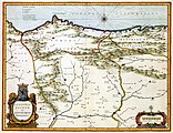
 Vol 4 - 057 - BARBARIA
 -
 Vol 4 - 058 - The City of ALGIER
 -
 Vol 4 - 059 - FEZZAE ET MAROCCHI REGNA AFRICAE CELEBERRIMA,
 -
 Vol 4 - 060 - Het KONINKLYK HOF met een gedeelte der Stadt MAROKKO = The royall palace with a part of y City
 -
 Vol 4 - 061 - NOVA EGYPTI TABULA
 -
 Vol 4 - 062 - ETHIOPIA SUPERIOR vel INTERIOR; vulgo ABISSINORUM sive PRESBITERI IOANNIS IMPERIUM
 -
 Vol 4 - 063 - NIGRATARVM REGIO
 -
 Vol 4 - 064 - GVINEA
 -
 Vol 4 - 065 - AETHIOPIA INFERIOR, vel EXTERIOR. Partes magis Septentrionalis, quae hic desiderantur, vide in tabula Ethiopiae Superioris
 -
 Vol 4 - 066 - Caerte vande Cabo de Bona ESPERANCA En haer gelegenheyt daer omtrent
 -
 Vol 4 - 067 - REGNA CONGO et ANGOLA
 -
 Vol 4 - 068 - INSULAE CANARIAE Alias FORTUNATAE dictae
 -
 Vol 4 - 069 - INSULAE PROMONTORII VIRIDIS Hispanis = ISLAS DE CABO VERDE, Belgis DE SOUTE EYLANDEN
 -
 Vol 4 - 070 - INSULA LAVRENTII, Vulgo MADAGASCAR
 -
 Vol 4 - 071 - Titelblad- AMERICA
 -
 Vol 4 - 072 - Novissima et Accuratissima TOTIUS AMERICAE DESCRIPTIO
 -
 Vol 4 - 073 - EXTREMA AMERICAE Versus Boream, ubi TERRA NOVA NOVA FRANCIA, Adjacentiaq-
 -
 Vol 4 - 075 - NOVA VIRGINIAE TABULA
 -
 Vol 4 - 076 - VIRGINIAE partis australis, et FLORIDAE partes orientalis, interjacentiumq- regionum NOVA DESCRIPTIO
 -
 Vol 4 - 077 - NOVA HISPANIA, ET NOVA GALICIA
 -
 Vol 4 - 078 - Panorama van- NOVA MEXICO
 -
 Vol 4 - 079 - YUCATAN Conventus Iuridici Hispaniae Novae Pars Occidentalis, et GVATIMALA CONVENTVS IVRIDICVS
 -
 Vol 4 - 080 - INSULAE AMERICANA in Oceano ADIACENTES, a C. de May usque ad Lineam AEquinoctialem
 -
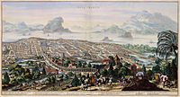
 Vol 4 - 081 - Panorama van- HAVANA
 -
 Vol 4 - 082 - CANIBALES INSULAE
 -
 Vol 4 - 083 - INSULA CURACAO
 -
 Vol 4 - 084 1 - AFBEELDINGH der heete rescontre te Water en te Lant op het EYLANDT TABAGO
 -
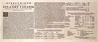 Vol 4 - 084 2 - Tekst bij de historieprent van de Nederlands-Franse zeeslag bij Tobago
 -
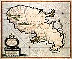 Vol 4 - 085 - INSULA MATANINO Vulgo MARTANICO
 -
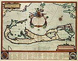 Vol 4 - 086 - Mappa AESIVARVM Insularum alias BARMVDAS dictarum, ad Ostia Mexicani aestuarij jacentium in latitudine Graduum 32 Minutorium 25 Ab Anglia
 -
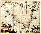
 Vol 4 - 088 - PERV
 -
 Vol 4 - 089 - CHILI
 -
 Vol 4 - 090 - TABVLA MAGELLANICA quà Tierrae del fuego, cum celeberrimus fretis a F. Magellano et I. Le Maire detectis novissima et accuratissima descriptio exhibetur
 -
 Vol 4 - 091 - PARAQVARIA Vulgo PARAGUAY, Cum adjacentibus
 -
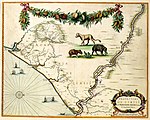
 Vol 4 - 092 - BRASILIA
 -
 Vol 4 - 093 - BAHIA DE TODOS OS SANC- TOS
 -
 Vol 4 - 094 - PRAEFECTURA DE CIRILI vel SEREGIPPE DELREY cum Itâpuama
 -
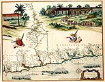
 Vol 4 - 095 - PRAEFECTURAE PARANAMBUCAE PARS BOREALIS, una cum PRAEFECTURA de ITAMARACA
 -
 Vol 4 - 096 - PRAEFECTURAE PARANAMBUCAE PARS MERIDIONALIS
 -
 Vol 4 - 097 - PRAEFECTURAE DE PARAIBA, ET RIO GRANDE
 -
 Vol 4 - 100 - Kaart van de Zuidpool


.jpg)


