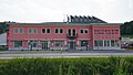
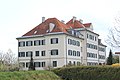
Bleiburg
municipality in Völkermarkt District, Carinthia, Austria
Deutsch: Bleiburg ist eine zweisprachige Stadt im österreichischem Bundesland Kärnten.
Slovenščina: Pliberk je mesto na avstrijskem Koroškem blizu meje s Slovenijo.
English: Bleiburg is an bilingual city in the Austrian state of Carinthia.
municipality in Völkermarkt District, Carinthia, Austria  .png) | |||||
| Upload media | |||||
| Instance of |
| ||||
|---|---|---|---|---|---|
| Location | Völkermarkt District, Carinthia, Austria | ||||
| Population |
| ||||
| Area |
| ||||
| Elevation above sea level |
| ||||
| official website | |||||
 | |||||
Aich/Dob
edit-
 English:
Place-name signDeutsch:
Ortstafel -
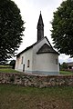
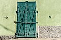
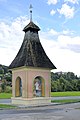
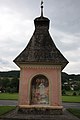
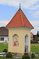
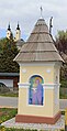
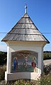
 Bildstock in Aich/Dob
 -
 Jauntalbrücke


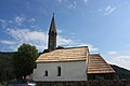
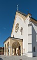
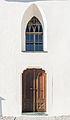
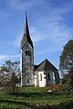
Filialkirche Sankt Sebastian
edit-
-

-

-

-
-
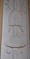
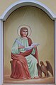
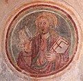
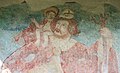 Christopherus
 -
 English:
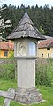
Sun-dialDeutsch:
Sonnenuhr


Bleiburg/Pliberk
edit-
 Markus Pernhart: Bleiburg und die Petzen

10. Oktoberplatz
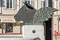
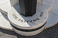
editFreyung fountain (created by Kiki Kogelnik) | Freyungsbrunnen (von Kiki Kogelnik geschaffen)
edit-
 English:
Western viewDeutsch:
West-Ansicht -
 English:
Southwestern viewDeutsch:
SW-Ansicht -
 English:
Southwestern viewDeutsch:
SW-Ansicht -
 English:
Northwestern viewDeutsch:
NW-Ansicht -
 English:
Southern viewDeutsch:
Süd-Ansicht -
 English:
Southern viewDeutsch:
Süd-Ansicht -
 English:
Southern viewDeutsch:
Süd-Ansicht -
 English:
Southern viewDeutsch:
Süd-Ansicht -
 English:
InscriptionDeutsch:
Inschrift


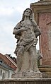
Plague column | Pestsäule
edit-
 English:
Western viewDeutsch:
West-Ansicht -
 English:
Western viewDeutsch:
West-Ansicht -
 English:
Western viewDeutsch:
West-Ansicht -
 English:
Saint Sebastian and Saint John of NepomukDeutsch:
Hl. Sebastian und Hl. Nepomuk -
 English:
Saint Sebastian and Saint John of NepomukDeutsch:
Hl. Sebastian und Hl. Nepomuk -
 English:
Saint Sebastian and Saint John of NepomukDeutsch:
Hl. Sebastian und Hl. Nepomuk -
 English:
St. SebastianDeutsch:
St. Sebastian -
 English:
St. NepomukDeutsch:
St. Nepomuk


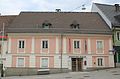
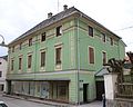
#2: Pharmacy | Nr. 2: Apotheke
edit-
 English:
Western viewDeutsch:
West-Ansicht

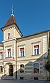
#4: Museum of Werner Berg | Nr. 4: Werner Berg Museum
edit-
 English:
Southern viewDeutsch:
Süd-Ansicht -
 English:
Southern viewDeutsch:
Süd-Ansicht -
 English:
Southern viewDeutsch:
Süd-Ansicht


#6 | Nr. 6
edit-
 10. Oktoberplatz 6

#8 | Nr. 8
edit-
 10. Oktoberplatz 8

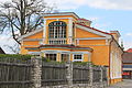
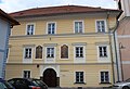
#10: Parents' house of Kiki Kogelnik | Nr. 10: Elternhaus der Kiki Kogelnik
edit-
 English:
Southeastern viewDeutsch:
SO-Ansicht -
 English:
PortalDeutsch:
Portal -
 English:
Southeastern viewDeutsch:
SO-Ansicht -
 English:
Iron doorDeutsch:
Eistentür


#14-16 | Nr. 14-16
edit-
 10. Oktoberplatz 14/16

#18 | Nr. 18
edit-
 10. Oktoberplatz 18

#22-24 | Nr. 22-24
edit-
 Oktoberplatz 22/24

#28 | Nr. 28
edit-
 Oktoberplatz 28

#30 | Nr. 30
edit-
 10. Oktoberplatz 30
 -
 10. Oktoberplatz 30


Bahnhofstraße
edit-
 Freibad
 -

-

-
 Volksschule
 -

-
 Bahnhofstraße: Hl Nepomuk
 -
 Haus Bahnhofstraße 10
 -
 Haus Bahnhofstraße 12
 -
 Haus Bahnhofstraße 12
 -
 Haus Bahnhofstraße 14
 -
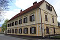
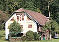
 Steinbergerhof
 -
 Steinbergerhof
 -
 Steinbergerhof
 -
 Grenzlandheim
 -
 Schlossmeierei
 -
 Schlossmeierei
 -
 Schlossmeierei
 -
 Kriederdenkmal
 -
 Kriederdenkmal


Graben
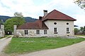
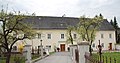
edit#8: Former citizen hospital | Nr. 8: Ehemaliges Bürgerspital
edit-
 English:
Southern viewDeutsch:
Süd-Ansicht -
 English:
Avant-corpsDeutsch:
Risalit -
 English:
Southsoutheastern viewDeutsch:
SSO-Ansicht -
 English:
Southwestern viewDeutsch:
SW-Ansicht -
 English:
Southwestern viewDeutsch:
SW-Ansicht


Kumeschgasse
edit#18: Former citizen hospital chapel Saint Erasmus | Nr. 18: Ehemalige Bürgerspitalskapelle hl. Erasmus
edit-
 English:
Eastern viewDeutsch:
Ost-Ansicht -
 English:
Northern viewDeutsch:
Nord-Ansicht -
 English:
Northern viewDeutsch:
Nord-Ansicht -
 English:
Northern viewDeutsch:
Nord-Ansicht


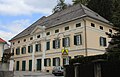
#18: District court | Nr. 18: Bezirksgericht
edit-
 English:
Eastern viewDeutsch:
Ost-Ansicht -
 English:
Eastern viewDeutsch:
Ost-Ansicht -
 English:
PortalDeutsch:
Portal -
 Bezirksgericht - detail
 -
 Bezirksgericht - detail


Rectory | Pfarrhof
edit-
 English:
Eastern viewDeutsch:
Ost-Ansicht

Postgasse
edit#10: House | Nr. 10: Haus
edit-
 English:
Number 10Deutsch:
Nummer 10

#13: Mory house | Nr. 13: Mory-Haus
edit-
 English:
Southwestern viewDeutsch:
SW-Ansicht -
 English:
Southwestern viewDeutsch:
SW-Ansicht -
 English:
Avant-corps and pedimentDeutsch:
Risalit und Ziergiebel -
 English:
Avant-corps and pedimentDeutsch:
Risalit und Ziergiebel -
 English:
Avant-corps and portalDeutsch:
Risalit und Portal -
 English:
PortalDeutsch:
Portal -
 English:
GateDeutsch:
Einfahrtstor -
 English:
GateDeutsch:
Einfahrtstor


#15: House | Nr. 15: Haus
edit-
 English:
Number 15Deutsch:
Nummer 15

Völkermarkter Straße
edit-
 English:
Slovenian Village HallDeutsch:
Slowenisches Kulturhaus -
 English:
Slovenian Village HallDeutsch:
Slowenisches Kulturhaus


Pestkreuz
edit-
 English:
Plague crossDeutsch:
Pestkreuz -
 English:
Plague crossDeutsch:
Pestkreuz -
 English:
Plague crossDeutsch:
Pestkreuz -
 English:
Plague cross, madonnaDeutsch:
Pestkreuz, Madonna -
 English:
Plague cross, crucifixionDeutsch:
Pestkreuz, Kreuzigung -
 English:
Plague cross, Peter and PaulDeutsch:
Pestkreuz, Peter und Paul -
 English:
Plague cross, Saint Florian and Saint NepomukDeutsch:
Pestkreuz, Hl Florian und Hl Nepomuk


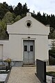
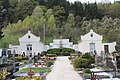
Friedhof
edit-
 Friedhofskapelle
 -

-
 Friedhofskapelle - detail
 -
 Friedhofskapelle - detail
 -
 Friedhofskapelle - Altar
 -
 Friedhofskapelle - Altar - detail
 -
 Gewölbe
 -
 Friedhofskapelle - Kreuz
 -
 Friedhofskapelle - Petrus
 -
 Friedhofskapelle - Paulus
 -
 Friedhofskapelle
 -


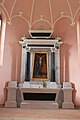
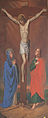
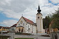
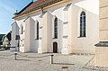
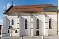
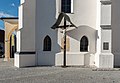
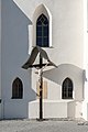
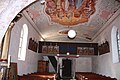
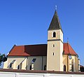
Parish church Saints Peter and Paul | Pfarrkirche Hll. Petrus und Paulus
edit-
 English:
Southwestern viewDeutsch:
SW-Ansicht -
 English:
Southwestern viewDeutsch:
SW-Ansicht -
 English:
Southwestern viewDeutsch:
SW-Ansicht -
 English:
Southwestern viewDeutsch:
SW-Ansicht -
 English:
Western view with staircaseDeutsch:
West-Ansicht mit Treppe -
 English:
Western view with staircaseDeutsch:
West-Ansicht mit Treppe -
 English:
Western viewDeutsch:
West-Ansicht -
 English:
Western viewDeutsch:
West-Ansicht -
 English:
Western viewDeutsch:
West-Ansicht -
 English:
Western porchDeutsch:
Westliche Vorhalle -
 English:
Western porchDeutsch:
Westliche Vorhalle -
 English:
Western porchDeutsch:
Westliche Vorhalle -
 English:
Western porchDeutsch:
Westliche Vorhalle -
 English:
Western porchDeutsch:
Westliche Vorhalle -
 English:
Western porchDeutsch:
Westliche Vorhalle -
 English:
Western porchDeutsch:
Westliche Vorhalle -
 English:
Western porchDeutsch:
Westliche Vorhalle -
 English:
Western portasDeutsch:
West-Portal -
 English:
Southern wallDeutsch:
Süd-Wand -
 English:
Southern wallDeutsch:
Süd-Wand -
 English:
Gravestone for Catharina MushinanDeutsch:
Grabstein für Catharina Mushinan -
 English:
GravestoneDeutsch:
Grabstein -
 English:
CrucifixDeutsch:
Kruzifix -
 English:
CrucifixDeutsch:
Kruzifix -
 English:
CrucifixDeutsch:
Kruzifix -
 English:
Southern portalDeutsch:
Süd-Portal -
 English:
ApseDeutsch:
Chorschluss -
 English:
ApseDeutsch:
Chorschluss -
 English:
Northern portal to the choirDeutsch:
Nordseitiges Portal zum Chor -
 Innenansicht
 -
 Innenansicht
 -
 Seitenkapelle
 -
 Blick auf die Orgel-Empore
 -
 Gewölbe
 -
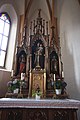
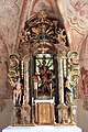
 Hochaltar
 -
 Hochaltar - Paulus
 -
 Hochaltar - Petrus
 -
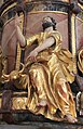
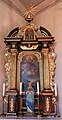
 Marienaltar
 -
 Marienaltar
 -
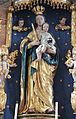 Marienaltar - Madonna
 -
 Marienaltar - Hl Florian
 -
 Linker Seitenaltar
 -
 Kanzel
 -
 Kanzel - Johannes
 -
 Kanzel - Lukas
 -
 Kanzel - Markus
 -
 Kanzel - Matthäus
 -
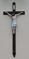
 Kreuzigungsgruppe
 -
 Kreuzigungsgruppe - Madonna
 -
 Kreuzigungsgruppe - Johannes
 -
 Hl Florian
 -
 Taufe Christi
 -
 Rosenkrnzkönigin
 -
-
 Maria Himmelfahrt
 -
 Chorgestühl
 -
 Taufstein


Others
edit-
 English:
Place-name signDeutsch:
Ortstafel -
 English:
CastleDeutsch:
Schloss -
 Brücke: Hl Nepomuk
 -
 Brücke: Kruzifix


Ebersdorf/Drveša vas
edit-
 Zweisprachige Ortstafel
 -
 Zollgebäude
 -
 Bahnhof


Sorgendorfer Brauerei
edit


Bildstöcke
edit-
 Bildstock Ebersdorf
 -
 Kreuzigung
 -
 Madonna
 -
 Peter und Paul
 -
 Johannes Evangelist
 -
 Bildstock Sorgendorf
 -
 Madonna


Einersdorf/Nonča vas
edit-
 English:
Place-name signDeutsch:
Ortstafel -
 English:
Subsidiary church “Assumption Day”Deutsch:
Subsidiary church “Assumption Day” -
 English:
Subsidiary church “Assumption Day”Deutsch:
Subsidiary church “Assumption Day” -
 English:
Subsidiary church “Assumption Day”Deutsch:
Subsidiary church “Assumption Day” -
 English:
Subsidiary church “Assumption Day”, cutoutDeutsch:
Subsidiary church “Assumption Day”, Ausschnitt -
 English:
Nave´s south wall of the subsidiary church “Assumption Day”Deutsch:
Südliche Schiffaußenwand der Filialkirche „Mariä Himmelfahrt“ -
 English:
FountainDeutsch:
Brunnen -
 English:
New castle “Staudachhof”Deutsch:
Staudachhof, Neues Schloss -
 English:
New castle “Staudachhof”, west viewDeutsch:
Staudachhof, Neues Schloss, West-Ansicht -
 Kreisverkehr bei Einersdorf


Landwirtschaftliche Gebäude
edit-
 English:
Kroff hovelDeutsch:
Kroff-Harpfe -
 English:
Kroff hovelDeutsch:
Kroff-Harpfe -
 English:
Kroff hovel, DetailDeutsch:
Kroff-Harpfe, Detail -
 English:
GrangeDeutsch:
Bauernhof -
 English:
BarnDeutsch:
Scheune -
 English:
BarnDeutsch:
Scheune


Bildstöcke
edit-
-
 Hl Florian
 -
 Hl Christophorus
 -
 Madonna
 -
 Pieta
Pieta -

-
 Bildstock
 -
 Madonna
 -
 Verklärung Christi
 -
 detail
 -


Heiligengrab
edit-
 English:
Pilgrimage church Holy Grave (Heiligengrab) at SchilterndorfDeutsch:
Wallfahrtskirche Heiligengrab in Schilterndorf -
 English:
Pilgrimage church Holy Grave (Heiligengrab) at SchilterndorfDeutsch:
Wallfahrtskirche Heiligengrab in Schilterndorf -
 English:
Pilgrimage church Holy Grave (Heiligengrab) at SchilterndorfDeutsch:
Wallfahrtskirche Heiligengrab in Schilterndorf -
 English:
Pilgrimage church Holy Grave (Heiligengrab) at SchilterndorfDeutsch:
Wallfahrtskirche Heiligengrab in Schilterndorf -
 English:
Pilgrimage church Holy Grave (Heiligengrab) at SchilterndorfDeutsch:
Wallfahrtskirche Heiligengrab in Schilterndorf -
 English:
Pilgrimage church Holy Grave (Heiligengrab) at SchilterndorfDeutsch:
Wallfahrtskirche Heiligengrab in Schilterndorf -
 English:
Pilgrimage church Holy Grave (Heiligengrab) at SchilterndorfDeutsch:
Wallfahrtskirche Heiligengrab in Schilterndorf -
 English:
Pilgrimage church Holy Grave (Heiligengrab) at SchilterndorfDeutsch:
Wallfahrtskirche Heiligengrab in Schilterndorf -
 English:
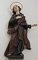
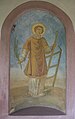
Holy NotburgaDeutsch:
Heilige Notburga -
 English:
Chapel next to the pilgrimage churchDeutsch:
Kapelle bei der Wallfahrtskirche


Bildstöcke
edit-
 English:
Lady DayDeutsch:
Mariä Verkündigung -
 English:
Lady DayDeutsch:
Mariä Verkündigung -
 English:
The VisitationDeutsch:
Mariä Heimsuchung -
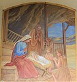 Christi Geburt
 -
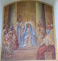
 Darbringung des Herrn
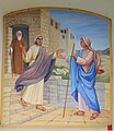
 -
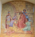
 Wiederfindung Jesu im Tempel
 -
 Christus am Ölberg
 -
 Geiselung
 -
 Dornenkrönung
 -
 Kreuztragung
 -
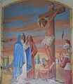 English:
CrucifixionDeutsch:
Kreuzigung -
 Auferstehung
 -
 Christi Himmelfahrt
 -
 Pfingsten
 -
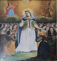
 Marienkrönung
 -
 Der gute Hirte


Moos | Blato
edit-
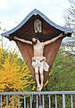
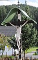 English:
Wayside crossDeutsch:
Schnitzkruzuifixus

Oberloibach
edit-
 English:
Subsidiary church Saint BartholomewDeutsch:
Filialkirche Heiliger Bartholomäus

Rinkolach/Rinkole
edit-
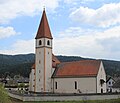
 Filialkirche Hl Oswald
 -

-

-
 Blick zur Orgelempore
 -
 Hauptaltar
 -
 Marienaltar
 -
 Johannes-der-Täufer-Altar
 -
 Deckengemälde - Krönung Mariens
 -
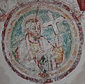
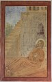
 Majestas Domini
 -
 Heilige Drei Könige
 -
 Engel
Engel -
 Apostel
 -
 Apostel
 -
 Apostel
 -
 Apostel
 -
 Apostel
 -
 Apostel
 -
 Apostel
 -
 Fresko-Rest
 -
 Fresko-Rest
 -
 Fresko-Rest
 -
 Scheune


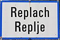
Replach/Replje
edit-
 English:
Bilingual place-name signDeutsch:
Zweisprachige Ortstafel -
-

-

-

-
-

-


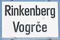
Rinkenberg/Vogrče
edit-
 English:
Bilingual place-name signDeutsch:
Zweisprachige Ortstafel -
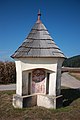
 Bildstock
 -
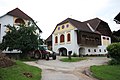
 Pfarrhof
 -
 Pfarrhof - Hl Josef
 -
 Pfarrhof - Gemälde


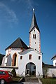
Pfarrkirche
edit-
 Pfarrkirche Hl Florian
 -
 Pfarrkirche Hl Florian
 -
 Blick auf die Orgelempore
 -
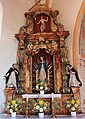
 Hauptaltar
 -
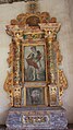
 Marien-Altar
 -
 Katarinenaltar
 -
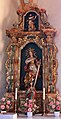
 St Florian-Altar
 -
 Hl Jakobus
 -
 Hl Antonius der Große
 -
 Christpherus-Fresko
 -
 Christus trägt das Kreuz
 -
 Auferstehung Christi
 -
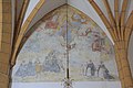
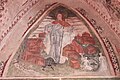
 Fresko - Weltengericht
 -
 Fresko - Hl Florian
 -
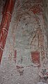
 Heilige
 -
 Ritter
 -
 Madonna
 -
 Hl Barbara
 -
 Hl Katarina
 -
 Hl Ulrich
 -
 Martyrium des Hl Florian
 -
 Martyrium des Hl Florian
 -
 Hl Nikolaus
 -
 Heiliger
 -
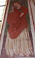
 Apostel Andreas
 -
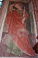
 Apostel Bartholomäus
 -
 Jakobus, Sohn des Alphäus
 -
 Apostel Johannes
 -
 Apostel Judas Thaddäus
 -
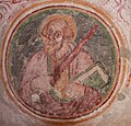
 Apostel Petrus
 -
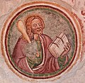
 Apostel Thomas
 -
 Apostel
 -
 Apostel
 -
 Apostel
 -
 Apostel
 -
 Schlußstein
 -
 Sonnenuhr
 -
 Decke im Vorraum


St Georgen
edit
St Luzia
edit-

-

-

-
 Kirche - Hl Lucia
 -
 Kirche - Hl Laurentius
 -
 Kirche - Heiliger
 -
 Hängebrücke Santa Lucia
 -
 Skulptur bei der Hängebrücke Santa Lucia


Unterloibach
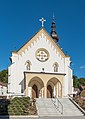
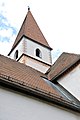
editSubsidiary church Saint Andrew | Filialkirche hl. Andreas
edit-
 English:
Southwestern viewDeutsch:
SW-Ansicht -
 English:
Southeastern viewDeutsch:
SO-Ansicht -
 English:
Southeastern viewDeutsch:
SO-Ansicht


Wiederndorf / Vidra vas
edit-
 English:
Bilingual place-name signDeutsch:
Zweisprachige Ortstafel

Sonstiges
edit-
 English:
Mlinar hovelDeutsch:
Mlinar-Harpfe -
 English:
Mlinar hovelDeutsch:
Mlinar-Harpfe -
 Felder nahe Bleiburg
 -
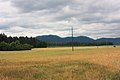 Felder nahe Bleiburg


Symbols and maps
edit-
 English:
Coat of armsDeutsch:
Gemeindewappen -
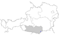 Location of Bleiburg within Austria
