Category:'t Loug 6, Spijk
| Object location | | View all coordinates using: OpenStreetMap |
|---|
building in Eemsdelta, Netherlands  | |||||
| Upload media | |||||
| Instance of | |||||
|---|---|---|---|---|---|
| Location | Spijk, Groningen, Eemsdelta, Groningen, Netherlands | ||||
| Street address |
| ||||
| Located on street |
| ||||
| Heritage designation |
| ||||
 | |||||
|
This is a category about rijksmonument number 9487
|
| Address |
|
Media in category "'t Loug 6, Spijk"
The following 10 files are in this category, out of 10 total.
-
 't Loug - Spijk - 20203187 - RCE.jpg 1,200 × 1,187; 395 KB
-
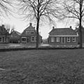 Kosterijpad - Spijk - 20203193 - RCE.jpg 1,200 × 1,197; 408 KB
-
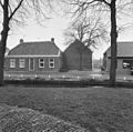
 Overzicht zijgevel - Spijk - 20203244 - RCE.jpg 1,197 × 1,200; 356 KB
-
 Rechterzijde - Spijk - 20203246 - RCE.jpg 1,195 × 1,200; 357 KB
-
 Spijk - 't Loug 6 - kosterij.jpg 3,787 × 2,841; 3.65 MB
-
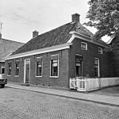
 Voorgevel - Spijk - 20203240 - RCE.jpg 1,186 × 1,200; 368 KB
-
 Voorgevel - Spijk - 20203245 - RCE.jpg 1,190 × 1,200; 332 KB
-
 Zijgevel - Spijk - 20203241 - RCE.jpg 1,195 × 1,200; 342 KB
-
 Zijgevel - Spijk - 20203242 - RCE.jpg 1,185 × 1,200; 371 KB
-
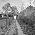 Zijpad - Spijk - 20203243 - RCE.jpg 1,200 × 1,192; 446 KB


