Category:Ørum Kirke (Thisted Kommune)
| Object location | | View all coordinates using: OpenStreetMap |
|---|
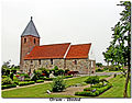
church building in Thisted Municipality, Denmark  | |||||
| Upload media | |||||
| Instance of | |||||
|---|---|---|---|---|---|
| Location | Thisted Municipality, North Denmark Region, Denmark | ||||
| Street address |
| ||||
| Diocese | |||||
| Religion or worldview | |||||
 | |||||
Pages in category "Ørum Kirke (Thisted Kommune)"
This category contains only the following page.
Media in category "Ørum Kirke (Thisted Kommune)"
The following 7 files are in this category, out of 7 total.
-
 Kirche Ørum (Thisted) I.jpg 2,848 × 4,288; 5.05 MB
-
 Kirche Ørum (Thisted) II.jpg 4,288 × 2,848; 5.67 MB
-
 Kirche Ørum (Thisted) III.jpg 4,288 × 2,848; 5.42 MB
-
 Kirche Ørum.jpg 4,288 × 2,848; 5.68 MB
-
 Lucie Ingermann Ørum Kirke.jpg 812 × 940; 310 KB
-
 Ørum kirke (Thisted).JPG 1,534 × 1,205; 812 KB
-
 Ørum-kirke-2000.jpg 894 × 715; 142 KB
_I.jpg)
_II.jpg)
_III.jpg)

.JPG)
