Category:Ōpōtiki District
territorial authority district in the Bay of Plenty Region, New Zealand   | |||||
| Upload media | |||||
| Instance of | |||||
|---|---|---|---|---|---|
| Location | Bay of Plenty Region, New Zealand | ||||
| Significant event |
| ||||
| Population |
| ||||
| Area |
| ||||
| Elevation above sea level |
| ||||
| official website | |||||
 | |||||
Subcategories
This category has the following 8 subcategories, out of 8 total.
C
- Christ Church, Raukokore (9 F)
M
- Motu River (11 F)
O
T
- Te Kaha (3 F)
W
- Waiaua River (Bay of Plenty) (3 F)
- Waiotahi (2 F)
Media in category "Ōpōtiki District"
The following 14 files are in this category, out of 14 total.
-

-
 Cape Runaway, NZ (622746407).jpg 1,473 × 1,000; 594 KB
-
 Coastal Farm New Zealand-1627.jpg 900 × 600; 738 KB
-
 Coastal Farm New Zealand-1630.jpg 600 × 900; 686 KB
-
 Crossing the upper reaches of the Waiaua River, Bay of Plenty (20686227273).jpg 6,438 × 4,696; 5.17 MB
-
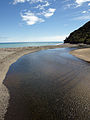 Hawai River, Opotiki District.jpg 1,536 × 2,048; 3.24 MB
-
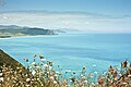 Maraenui Hill Lookout 1.jpg 900 × 600; 545 KB
-
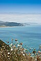 Maraenui Hill Lookout 2.jpg 600 × 900; 529 KB
-
 NZ-Cape Runaway.png 413 × 600; 27 KB
-
 Opotiki DC.PNG 251 × 376; 23 KB
-
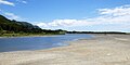 Raukokore River.jpg 2,048 × 1,024; 2.04 MB
-
 Waihau Bay launching area and Hotel - panoramio.jpg 2,816 × 1,880; 2.61 MB
-
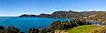 Whitianga Bay.jpg 9,430 × 2,947; 11.03 MB
-
 Ōmāio Soldiers’ Memorial Church.jpg 5,273 × 3,744; 14.01 MB
.jpg)
.jpg)


.jpg)


