Category:Šakiai in maps
This category includes the images that spot Šakiai city in larger geographical area. For maps that specifically represent the city of Šakiai more in detail, see Category:Maps of Šakiai.
Media in category "Šakiai in maps"
The following 5 files are in this category, out of 5 total.
-
 Reymanns Kowno.jpg 5,672 × 3,983; 7.15 MB
-
 WIG Mapa Operacyjna Polski - 36 Suwałki-Kowno 1932.jpg 6,376 × 5,831; 9.32 MB
-
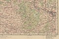 R200 N34-06se.jpg 2,244 × 1,513; 4.19 MB
-
 USSR map NN 34-6 Kaunas.jpg 5,735 × 4,336; 8.33 MB
-
 LietuvaSakiai.png 721 × 556; 28 KB


