Category:1410s maps of Europe
Temperate regions: Europe · – Polar regions: – Other regions:
Subcategories
This category has the following 3 subcategories, out of 3 total.
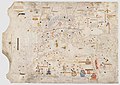
Media in category "1410s maps of Europe"
The following 4 files are in this category, out of 4 total.
-
-
 Mussa Melli and Timbuktu Cropped from 1413 Portolan chart by Mecia de Viladestes.jpg 1,387 × 1,306; 281 KB
-

-
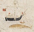 Whaling Cropped from 1413 Portolan chart by Mecia de Viladestes.jpg 1,664 × 1,536; 337 KB


