Category:14th-century maps of Europe
Temperate regions: North America · Africa · Europe · Asia · Oceania – Polar regions: – Other regions:
Subcategories
This category has the following 25 subcategories, out of 25 total.
#
- 1310s maps of Europe (1 F)
*
B
C
E
- 14th-century maps of England (1 F)
G
- 14th-century maps of Georgia (9 F)
- 14th-century maps of Greece (1 F)
I
- 14th-century maps of Ireland (2 F)
L
R
- 14th-century maps of Romania (1 F)
- 14th-century maps of Russia (5 F)
S
T
U
- 14th-century maps of Ukraine (5 F)
Media in category "14th-century maps of Europe"
The following 11 files are in this category, out of 11 total.
-
 Dalorto 1325 map (partial).jpg 1,600 × 949; 563 KB
-

-
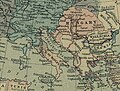 NAP-HUN 1360.JPG 662 × 503; 104 KB
-
 Pestilence spreading 1347-1351 europe.png 1,280 × 1,387; 350 KB
-

-
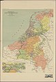
 TA REC 020 Kaart Zuid-Hollandse eilanden 1300.jpg 6,017 × 4,342; 6.38 MB
-
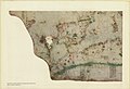
 TA REC 042 Kaart De gewesten van Noord- en Zuid-Nederland ±1300.jpg 5,942 × 8,634; 11.9 MB
-
 The portolan chart of Angellino de Dalorto, 1325 (nla.obj-233480935).jpg 5,000 × 3,452; 10.19 MB
-
 The portolan chart of Angellino de Dalorto, 1325 (nla.obj-233481045).jpg 5,000 × 3,427; 10.68 MB
-
 The portolan chart of Angellino de Dalorto, 1325 (nla.obj-233481158).jpg 5,000 × 3,429; 9.95 MB
-
 The portolan chart of Angellino de Dalorto, 1325 (nla.obj-233481264).jpg 5,000 × 3,489; 11.2 MB
.jpg)


.jpg)


.jpg)
.jpg)
.jpg)
.jpg)