Category:1513 maps
| · 1510 · 1511 · 1512 · 1513 · 1514 · 1515 · 1516 · 1517 · 1518 · 1519 · → |
Deutsch: Karten mit Bezug zum Jahr 1513
English: Maps related to the year 1513
Español: Mapas relativos al año 1513
Français : Cartes concernant l’an 1513
Русский: Карты 1513 года
Subcategories
This category has the following 5 subcategories, out of 5 total.
Media in category "1513 maps"
The following 24 files are in this category, out of 24 total.
-

-
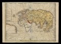
 1513 map centered on Transylvania by Paolo Forlani.jpg 8,860 × 12,529; 22.15 MB
-
 1513 Ptolemaic world map by Martin Waldseemüller.jpg 13,720 × 10,563; 23.08 MB
-
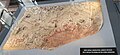 A peculiar map drawn by the Turkish admiral Piri Reis around 1513.jpg 3,293 × 1,508; 2.58 MB
-
 Argentine Ptolemy Ireland 1513.jpg 1,039 × 1,153; 599 KB
-
 Decima Asiae Tabula RMG F0284.tiff 7,545 × 5,450; 117.65 MB
-
 Decima Asiae Tabula RMG L6856-001.tiff 4,800 × 3,537; 48.57 MB
-
 Decima Asiae Tabula RMG L6856-002.tiff 4,800 × 3,504; 48.12 MB
-
 Granada 12 32 20 053000.jpeg 4,032 × 3,024; 3.12 MB
-
 Houghton MS Ital 144 - Maggiolo, 1513.png 2,347 × 1,896; 5.53 MB
-
 Orbis Typus Universalis Juxta Hydrographorum Traditionem. RMG F1973.tiff 7,196 × 5,230; 107.67 MB
-
 Orbis Typus Universalis Juxta Hydrographorum Traditionem. RMG L6851-001.tiff 4,800 × 3,490; 47.93 MB
-
 Orbis Typus Universalis Juxta Hydrographorum Traditionem. RMG L6851-002.tiff 4,800 × 3,514; 48.26 MB
-
 Orbis Typus Universalis Juxta Hydrographorum Traditionem. RMG L7405-001.tiff 4,800 × 3,499; 48.05 MB
-
 Orbis Typus Universalis Juxta Hydrographorum Traditionem. RMG L7405-002.tiff 4,800 × 3,499; 48.05 MB
-
 Piri Reis en proyección acimutal de Lambert con centro en el norte Mar Rojo.svg 1,004 × 1,004; 35 KB
-
 Piri reis world map 01.jpg 1,964 × 2,619; 7.08 MB
-
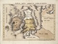
 Ptolemy, Quarta Asiae tabula (FL199985829 2368925).jpg 8,000 × 6,100; 25.7 MB
-
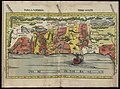 Ptolemy, Tabula moderna Terre Sancte (FL6882844 2368927).jpg 8,712 × 6,472; 84.4 MB
-
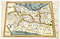 QUINTA ASIE TABULA 1513.jpg 2,016 × 1,324; 560 KB
-
 Tabula nova Hibernie Anglie et Scotie RMG F0255.jpg 1,280 × 985; 1.31 MB
-
 Tabula nova Hibernie Anglie et Scotie RMG F0255.tiff 7,225 × 5,562; 114.97 MB
-
 Tabula nova Hibernie Anglie et Scotie RMG L8561-001.jpg 1,280 × 1,000; 1.44 MB
-
 Tabula nova Hibernie Anglie et Scotie RMG L8561-002.jpg 1,280 × 999; 1.2 MB


.jpg)
.jpg)


