Category:1560s maps of Brazil
Countries of the Americas: Brazil
Media in category "1560s maps of Brazil"
The following 6 files are in this category, out of 6 total.
-
 1562 Diego Gutierrez Amazonas.jpg 640 × 480; 110 KB
-
 1565 Brasil Ramusio Delle Navigationi vol3 pp427-428.png 1,104 × 872; 2.74 MB
-
 Brazil WDL807.png 1,271 × 1,024; 2.61 MB
-
 Egnazio Danti - Bolivia and Western Amazzonia - Google Art Project.jpg 5,693 × 9,075; 22.08 MB
-
 Egnazio Danti - Brasil and the Amazon river - Google Art Project.jpg 3,327 × 9,459; 15.2 MB
-
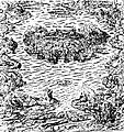 Ile-de-villegagnon.jpg 600 × 639; 195 KB


