Category:1584 maps of Europe
Temperate regions: North America · South America · Africa · Europe · – Polar regions: – Other regions:
English: 1584 maps of Europe
Español: Mapas de Europa en 1584
Suomi: Euroopan kartat vuodelta 1584
Română: Hărți ale Europei din 1584
Subcategories
This category has the following 3 subcategories, out of 3 total.
Media in category "1584 maps of Europe"
The following 3 files are in this category, out of 3 total.
-
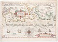 East Friesland 1584 map by Waghenaer.jpg 2,500 × 1,809; 814 KB
-
 Flandria (Vlaanderen Flanders) 1584 Map by Abraham Ortelius.jpg 12,583 × 9,989; 44.7 MB
-
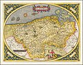
 Palatinatus Bavariae Descriptio 1584 - Abraham Ortelius.jpg 2,207 × 1,800; 1.08 MB

_1584_Map_by_Abraham_Ortelius.jpg)
