Category:1590s maps of Portugal
Countries of Europe: Albania · Armenia‡ · Austria · Belgium · Bosnia and Herzegovina · Bulgaria · Croatia · Cyprus‡ · Denmark · Estonia · Finland · France‡ · Georgia‡ · Germany · Greece · Hungary · Iceland · Italy · Lithuania · Netherlands‡ · Norway · Poland · Portugal‡ · Romania · Russia‡ · Spain‡ · Sweden · Turkey‡ · Ukraine
‡: partly located in Europe
‡: partly located in Europe
Subcategories
This category has only the following subcategory.
Media in category "1590s maps of Portugal"
The following 5 files are in this category, out of 5 total.
-
 "Hispaniae regnum," 1597 closer view.jpg 800 × 600; 200 KB
-
-
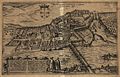
 Coimbra (Braun – Hogenberg, 1598).jpg 1,929 × 1,224; 1.15 MB
-
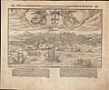
 Illustris civitatis Comimbriae in Lusitania 1600 Georg Braun.jpg 1,343 × 863; 663 KB
-
 Península Ibérica em Thalassographica Tabula totius maris mediterranei (1594).jpg 2,808 × 2,039; 3.93 MB


.jpg)

.jpg)