Category:1590s maps of the Caribbean
Subcategories
This category has the following 2 subcategories, out of 2 total.
- 1594 maps of the Caribbean (1 F)
B
- 1590s maps of the Bahamas (1 F)
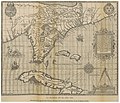
Media in category "1590s maps of the Caribbean"
The following 10 files are in this category, out of 10 total.
-
 DeBry Map of Caribbean & Florida1594.jpg 1,619 × 1,092; 1.68 MB
-

-
 RUIDIAZ(1893) 1.033 LA FLORIDA EN EL AÑO 1591.jpg 4,121 × 3,549; 8.46 MB
-
 AMH-6604-KB Map of South America.jpg 2,400 × 1,795; 1.2 MB
-

-

-

-

-

-
 Florida Moyne 1591.jpeg 3,501 × 2,542; 1.34 MB

_-_AHG.jpg)
_1.033_LA_FLORIDA_EN_EL_A%C3%91O_1591.jpg)

_-_btv1b8446546r.jpg)

.jpg)

._Afbeeldinghe_van_alle_de_Zee_custen_des_gheheelen_Zuyderschen_deels_van_America..._-_btv1b8446545b.jpg)
