Category:1595 maps of Europe
English: 1595 maps of Europe
Español: Mapas de Europa en 1595
Suomi: Euroopan kartat vuodelta 1595
Română: Hărți ale Europei din 1595
Subcategories
This category has the following 5 subcategories, out of 5 total.
Media in category "1595 maps of Europe"
The following 5 files are in this category, out of 5 total.
-
 1st Polish Commonwealth at its greatest extent.png 1,024 × 1,038; 200 KB
-
 5. 1595 Norden Sverige udvider grænserne i Estland og Finland.png 2,000 × 2,541; 624 KB
-
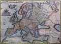 Abraham Ortelius Map of Europe.jpg 2,691 × 1,965; 5.92 MB
-
 Anthropomorphic map of Europe by Heinrich Bünting.jpg 4,254 × 2,946; 12.47 MB
-
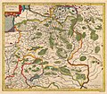 Vialikaje Kniastva Litoŭskaje. Вялікае Княства Літоўскае (G. Mercator, 1595).jpg 2,840 × 2,474; 6.81 MB


.jpg)