Category:1610s maps of Belarus
Countries of Europe: Armenia‡ · Azerbaijan‡ · Belarus · Belgium · Cyprus‡ · Denmark · Finland · France‡ · Georgia‡ · Germany · Greece · Iceland · Republic of Ireland · Italy · Lithuania · Netherlands‡ · Norway · Poland · Portugal‡ · Romania · Russia‡ · Spain‡ · Sweden · Turkey‡ · Ukraine
‡: partly located in Europe
‡: partly located in Europe
Media in category "1610s maps of Belarus"
The following 6 files are in this category, out of 6 total.
-
 Бабіца на мапе 1613 г.jpg 624 × 308; 35 KB
-
 Брагін на карце ВКЛ 1613 г. Гравюра Томаша Макоўскага (фрагмент).png 624 × 546; 365 KB
-
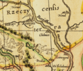
 Брагін на мапе 1613 г.jpg 624 × 314; 33 KB
-
 Брагін, Лоева Гара і Астраглядавічы на мапе ВКЛ 1613 г.jpg 624 × 307; 34 KB
-
 Мястэчка Холмеч на мапе ВКЛ 1613 г.png 1,572 × 1,335; 4.64 MB
-
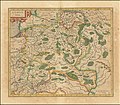 Vialikaje Kniastva Litoŭskaje. Вялікае Княства Літоўскае (G. Mercator, 1619).jpg 8,483 × 7,391; 43.58 MB

.png)


.jpg)