Category:1620s maps of the Netherlands
Countries of Europe: Cyprus‡ · Denmark · Finland · France‡ · Georgia‡ · Germany · Greece · Republic of Ireland · Italy · Netherlands‡ · Poland · Portugal‡ · Russia‡ · Spain‡ · Turkey‡ · Ukraine
‡: partly located in Europe
‡: partly located in Europe
Subcategories
This category has the following 3 subcategories, out of 3 total.
Media in category "1620s maps of the Netherlands"
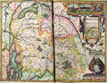
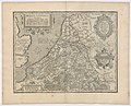
The following 24 files are in this category, out of 24 total.
-
 4138-002 Print 15869kopie.jpg 500 × 387; 2.26 MB
-
 Amstelodamum, celebre emporium formâ planâ - btv1b532254838 (2 of 3).jpg 8,469 × 6,295; 12.49 MB
-
-
 Antwerp - Marchionatus sacri Romani imperii.jpg 14,217 × 12,003; 58.44 MB
-
 Belgii veteris typus (8345414951).jpg 800 × 679; 142 KB
-

-
 Breda novis operibus post Spinolae adventum munita (BM 1848,0205.361).jpg 2,500 × 1,702; 1,005 KB
-
 Abriss der Gelegenheit der Statt Schlevs (BM 1870,1112.218).jpg 2,500 × 1,552; 879 KB
-

-

-
-

-
 Kaart van graafschap Zutphen, 1627 Comitatus Zutphania (titel op object), RP-P-OB-81.150.jpg 5,750 × 4,552; 5.71 MB
-
 Fortifikationskarta över Bergen-op-zoom med omgivningar i Holland - Skoklosters slott - 99060.tif 4,767 × 3,499, 2 pages; 47.75 MB
-

-
 Aenwysinge van s'Hertogenbos belegert den 1en mey 1629 - btv1b532255576 (2 of 3).jpg 5,385 × 4,413; 5.38 MB
-

-

-
 Hugo-de-Groot-Grollæ-obsidio-cvm-annexis-anni-M-DC-XXVII MG 0147.tif 4,218 × 3,565; 43.06 MB
-
 Balthasar Florisz. van Berckenrode, Comitatus Hollandiæ novissima descriptio (FL35073081 2535996).jpg 13,492 × 11,175; 217.89 MB
-
 De Wormer in de vorm van een vogel.jpeg 2,500 × 1,752; 673 KB
-

-

-
 Hugo-de-Groot-Grollæ-obsidio-cvm-annexis-anni-M-DC-XXVII MG 0146.tif 4,708 × 3,631; 48.94 MB

.jpg)
.jpg)

.jpg)
.jpg)
.jpg)
.jpg)
_(BM_1870,1112.223).jpg)
_(BM_1870,1112.208).jpg)
_(BM_1874,0613.2525).jpg)
_Corte_Verklaringe_der_ghelegentheyt,_Stercte,_ende_tegenwoordige_Belegeringhe_der_Stadt_Grolle,_gelegen_in_t%27Graefschap_Zutphen_(titel_op_object),_RP-P-OB-81.149.jpg)
,_RP-P-OB-81.150.jpg)
_den_eersten_ma%C3%BF_1629_-_btv1b53225560g_(2_of_3).jpg)
.jpg)


.jpg)


