Category:1630s maps
| 17th-century maps: ← 1600s 1610s 1620s 1630s 1640s 1650s 1660s 1670s 1680s 1690s → |
Not to be confused with maps depicting the 1630s.
Subcategories
This category has the following 18 subcategories, out of 18 total.
*
1
A
E
Media in category "1630s maps"
The following 5 files are in this category, out of 5 total.
-
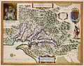 Atlas Van der Hagen-KW1049B13 075-NOVA VIRGINIAE TABULA.jpeg 5,500 × 4,321; 3.75 MB
-
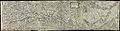 Carte de Haute-Alsace, Basse-Alsace et Palatinat du Rhin.jpg 20,570 × 5,385; 22.82 MB
-
 Glovers map of Brentford battle.jpg 640 × 808; 150 KB
-
 Helmink Antique map of Holland by Anonymous 3rd state by Frederick de Wit 1630.jpg 6,946 × 5,728; 40 MB
-
 Nova Belgica et Anglia Nova (2675719332).jpg 2,000 × 1,680; 2.65 MB


.jpg)