Category:1630s maps of North Rhine-Westphalia
Federal states of Germany:
Media in category "1630s maps of North Rhine-Westphalia"
The following 4 files are in this category, out of 4 total.
-

-
 Atlas ou Representation du Monde Universel t. 2. 1633 (110099946).jpg 16,745 × 11,981; 34.39 MB
-
 Moers graafschap.jpg 606 × 439; 426 KB
-
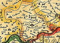
 Tecklenburg 1633.png 334 × 381; 303 KB
.jpg)
.jpg)

