Category:1643 maps
| ← · 1640 · 1641 · 1642 · 1643 · 1644 · 1645 · 1646 · 1647 · 1648 · 1649 · → |
Deutsch: Karten mit Bezug zum Jahr 1643
English: Maps related to the year 1643
Español: Mapas relativos al año 1643
Français : Cartes concernant l’an 1643
Русский: Карты 1643 года
Subcategories
This category has the following 4 subcategories, out of 4 total.
- 1643 maps by country (empty)
A
- 1643 maps of Africa (4 F)
- 1643 maps of Asia (empty)
E
- 1643 maps of Europe (2 F)
Media in category "1643 maps"
The following 18 files are in this category, out of 18 total.
-
 1643-Guadeloupe-Boisseau.jpg 747 × 600; 81 KB
-

-
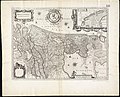
 De Merian Sueviae 004.jpg 4,320 × 3,384; 1.66 MB
-
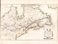
 Description de la Nouvelle France - ou sont remarquees les diverses habitations des Francois.jpg 4,464 × 3,031; 12.52 MB
-

-
-
 Hollandia comitatus (8341892423).jpg 800 × 650; 136 KB
-

-
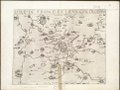
 L'Isle de France et lieux circövoysins (5121153334).jpg 2,000 × 1,514; 2.77 MB
-
 L'Isle de France et lieux circövoysins - Norman B. Leventhal Map Center.tif 5,207 × 3,941; 58.74 MB
-
 L'Isle de France et lieux circövoysins.jpg 5,207 × 3,941; 10.04 MB
-

-
-
 Olmütz (Merian).jpg 1,884 × 1,688; 915 KB
-
 Olomouc map 1643 and 1644.jpg 1,620 × 1,526; 1.71 MB
-
 Plymouth siege map 1643.jpg 4,075 × 2,921; 2.89 MB
-
 Siège de Thionville par le duc d'Enghien.jpg 1,421 × 1,022; 688 KB
-
 Territorium Francofurtensis 1643.jpg 3,603 × 3,008; 6.1 MB

.jpg)


.jpg)
.jpg)
.jpg)


.jpg)


