Category:1644 maps of England
Media in category "1644 maps of England"
The following 6 files are in this category, out of 6 total.
-
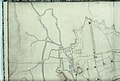
 Bodleian Libraries, North east Oxford, with River Cherwell.jpg 1,000 × 675; 106 KB
-
-

-
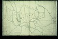 Bodleian Libraries, Plan of Oxford City fortifications, 13 November 1644.jpg 1,000 × 675; 96 KB
-
 Bodleian Libraries, South east Oxford, with River Thames and Eastgate.jpg 1,000 × 675; 111 KB
-
 Bodleian Libraries, South west Oxford, with River Thames and Christ Church.jpg 1,000 × 675; 111 KB


ties_forces,_an_1644.jpg)


