Category:1650 maps of North America
Temperate regions: North America · South America · Africa · Europe · Asia · – Polar regions: – Other regions:
English: 1650 maps of North America
Subcategories
This category has the following 2 subcategories, out of 2 total.
.
- 1650 maps of the Caribbean (1 F)
C
- 1650 maps of Canada (1 F)
Media in category "1650 maps of North America"
The following 11 files are in this category, out of 11 total.
-
 1650SansonLargeDull.jpg 6,743 × 4,712; 5.63 MB
-
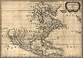
 Amérique septentrionale LOC 2003623388.jpg 6,743 × 4,712; 5.66 MB
-
 Amérique septentrionale LOC 2003623388.tif 6,743 × 4,712; 90.9 MB
-
 Amérique septentrionale LOC 2003623390.jpg 6,793 × 4,972; 5.28 MB
-
 Amérique septentrionale LOC 2003623390.tif 6,793 × 4,972; 96.63 MB
-
 Amérique septentrionale old map.jpg 1,685 × 1,178; 601 KB
-
 Capitanía General de Guatemala 1650.png 1,290 × 1,122; 352 KB
-
 Carte 1650 de la Nouvelle-France par Nicolas Sanson.jpg 4,344 × 2,889; 5.83 MB
-
 Carte de Saint-Christophe Sanson 1650.png 3,207 × 2,358; 8.83 MB
-
 Insel Kalifornien 1650.jpg 1,813 × 1,300; 3.29 MB
-
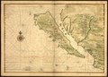 Map of California Shown as an Island WDL2661.png 1,435 × 1,024; 3 MB


