Category:1650s maps of Scotland
Subcategories
This category has only the following subcategory.
B
- Blaeu Atlas of Scotland 1654 (54 F)
Media in category "1650s maps of Scotland"
The following 55 files are in this category, out of 55 total.
-
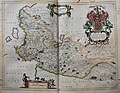
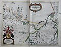
 Atlas Van der Hagen-KW1049B11 042-GALLOVIDIA vernacule GALLOWAY.jpeg 5,500 × 4,374; 2.74 MB
-
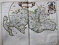
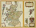 Atlas Van der Hagen-KW1049B11 038-SCOTIA REGNUM cum insulis adjacentibus.jpeg 5,500 × 4,276; 3.53 MB
-

-
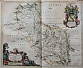
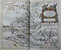
 Atlas Van der Hagen-KW1049B11 043-COILA PROVINCIA THE PROVINCE OF KYLE.jpeg 5,500 × 4,353; 3.75 MB
-

-

-

-

-
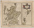
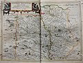
 Blaeu - Atlas of Scotland 1654 - SCOTIA ANTIQUA - Old Scotland.jpg 6,492 × 4,975; 8.4 MB
-
-
 UBBasel Map Grönland Island Britische Inseln 1657 Kartenslg Mappe 247-52.tif 10,579 × 8,337, 2 pages; 252.36 MB
-

-

-
 "Buthe Insula vulgo The Yle of Boot - Auct. Tim Pont" (22246521752).jpg 3,894 × 3,108; 1.9 MB
-
 "Cantyra Cherfonefus = Cantyr Ademie-Yland - Auctor Timoth. Pont" (22071288440).jpg 3,696 × 3,096; 1.74 MB
-
 "Carricta Borealis vulgo The nort part of Carrick - Opus Timothei Pont" (22071372370).jpg 3,804 × 3,088; 2.46 MB
-
 "Carricta Meridionales = The south part of Carrick - Auct. Tim. Pont" (22270783471).jpg 4,083 × 3,037; 2.34 MB
-
 "Cathenesia = Caithness - Auct. Timotheo Pont" (22259080755).jpg 3,945 × 2,947; 2.06 MB
-
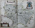 "Coila Provincia = The province of Kyle - Auct. Timoth. Pont" (21638325603).jpg 3,826 × 3,084; 2.8 MB
-
 "Cuninghamia - ex Schedis Timotheo Pont" (22257714012).jpg 3,934 × 3,036; 2.21 MB
-
 "Evia et Escia Scotis Eusdail et Eskdail - Auct. Tim. Pont" (21638495513).jpg 3,756 × 3,087; 2.03 MB
-

-
 "Fifae Pars Occidentalis = The West part of Fife." (22071187850).jpg 3,976 × 3,126; 2.14 MB
-
 "Fifae Pars Orientalis = The East Part of Fife" (22071201160).jpg 3,948 × 3,156; 2.22 MB
-
 "Fifae vicecomitatus = The Sherifdome of Fyfe" (22233141886).jpg 3,858 × 3,154; 2.45 MB
-
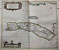
 "Gallovidia vernacule Galloway - Auct. Timothy Pont" (22233386576).jpg 4,188 × 3,168; 2.56 MB
-

-

-

-
-

-

-

-

-
 "Laudelia Sirve Lauderdalia Scotis vulgo Lauderdail - Auct. Timothy Pont" (22246758202).jpg 3,942 × 3,042; 1.91 MB
-
 "Leogus et Haraia insulae ex Aebudarum numero." (21636250514).jpg 4,068 × 3,066; 2.1 MB
-

-
 "Lidalia vel Lidisdalia Regio. Lidisdail - Auct. Timotheo Pont" (22259509785).jpg 3,935 × 3,160; 2.46 MB
-

-

-

-

-
 "Orcadum et Schetlandiae insularum accuratissima descriptio." (21636210744).jpg 4,095 × 3,139; 2.43 MB
-

-
 "Praefectura Kircvbriensis" (22233372496).jpg 3,771 × 3,036; 2.43 MB
-

-

-
 "Skia vel Skiana = The Yle of Skie - Auct. Timotheo Pont." (22071287748).jpg 3,747 × 3,085; 1.89 MB
-
 "Southerlandia" (22072260979).jpg 4,073 × 3,038; 2.4 MB
-
 "Sterlinensis preafectura = Sterlin-Shyr - Auct. Thiomth. Pont." (22072280450).jpg 3,862 × 3,061; 2.31 MB
-
 "Strath- Navernia = Strath-Navern - Auct. Timotheo Pont" (21636337084).jpg 3,618 × 3,036; 2.09 MB
-
 "Teviotia vulgo Tivedali - Auct. Tim Pont." (22246735362).jpg 3,771 × 3,064; 2.35 MB
-
-

-


.jpg)


_-_btv1b530564368_(1_of_2).jpg)
%22_(22259588395).jpg)
.jpg)
.jpg)
.jpg)
.jpg)
.jpg)
.jpg)
.jpg)
.jpg)
.jpg)
.jpg)
.jpg)
.jpg)
.jpg)
.jpg)
.jpg)
t(h)_the_Regalitie_of_Glen_Luze,_bot_in_Galloway_-_Auct._Timothy_Pont%22_(22246642012).jpg)
.jpg)
.jpg)
.jpg)
.jpg)
.jpg)
.jpg)
.jpg)
.jpg)
.jpg)
.jpg)
t(h)_the_Yles_and_provinces_bordering_there-upon_-_Auct._Timoth._Pont%22_(22071147560).jpg)
.jpg)
.jpg)
.jpg)
.jpg)
.jpg)
.jpg)
.jpg)
.jpg)
.jpg)
.jpg)
.jpg)
.jpg)
.jpg)
.jpg)
.jpg)
.jpg)