Category:1662 maps of South America
Temperate regions: North America · South America · Africa · Europe · Asia · – Polar regions: – Other regions:
| ← 1660 1661 1662 1664 1665 1666 1667 1668 1669 → |
Media in category "1662 maps of South America"
The following 2 files are in this category, out of 2 total.
-
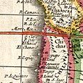
 Atlas Van der Hagen-KW1049B13 091-PARAQVARIA Vulgo PARAGUAY, Cum adjacentibus.jpeg 5,500 × 4,458; 3.69 MB
-
 Límite de Chile y Perú en el río Loa, año 1662.jpg 339 × 339; 72 KB

