Category:1678 maps
| ← 1670 1671 1672 1673 1674 1675 1676 1677 1678 1679 → |
Deutsch: Karten mit Bezug zum Jahr 1678
English: Maps related to the year 1678
Español: Mapas relativos al año 1678
Français : Cartes concernant l’an 1678
Русский: Карты 1678 года
Subcategories
This category has the following 3 subcategories, out of 3 total.
A
- 1678 maps of Africa (1 F)
- 1678 maps of Asia (empty)
E
Media in category "1678 maps"
The following 24 files are in this category, out of 24 total.
-
 A coelestiall (sic) planisphere RMG F9890.tiff 5,388 × 4,620; 71.22 MB
-
 Alexis Hubert Jaillot, Hierusalem Saincte Cité de Dieu (FL6879254 2368096).jpg 2,810 × 2,166; 3.02 MB
-

-
 Carte pour servir a l eclaircissement du papier terrier de la Nouvelle-France.png 2,516 × 1,444; 6.87 MB
-

-

-
 Deiggitsch Alben2.jpg 1,517 × 1,061; 748 KB
-
 Detail Chamlay kaart.png 887 × 455; 1.1 MB
-
 Diocese de larchevesche de Bourges (4587190244).jpg 2,000 × 1,547; 3.36 MB
-
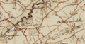
 Essex actually surveyed with the several Roads from London &c. ... (5384791549).jpg 2,000 × 1,590; 3.75 MB
-
 Karta över Tyska Imperiet, 1678 - Skoklosters slott - 97984.tif 5,272 × 3,656; 55.16 MB
-
 Laßnitz zwischen Murau und Friesach.jpg 961 × 881; 468 KB
-
 Map of Ragusa retouched.jpg 770 × 636; 412 KB
-

-

-

-

-
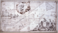
 Philipp Clüver, Totius Terræ Sanctæ Delineatio (FL37105340 3886752).jpg 7,832 × 6,736; 74.65 MB
-
 Sg 1678 beling.jpg 3,641 × 2,488; 6.49 MB
-
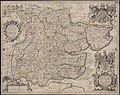
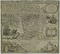 Styriae Ducatus Fertilissimi Nova Geographica Descriptio 1678.jpg 16,334 × 14,621; 44.31 MB
-

-

-
 Western Atlantic RMG K0998.jpg 980 × 1,280; 1.56 MB
-
 Zemljevid Rogatca iz 1678.jpg 899 × 699; 538 KB
.jpg)
.jpg)


.jpg)
.jpg)


.jpg)

.jpg)
.jpg)


