Category:1680s maps of Canada
Subcategories
This category has the following 8 subcategories, out of 8 total.
- 1680 maps of Canada (2 F)
- 1682 maps of Canada (1 F)
- 1686 maps of Canada (2 F)
- 1688 maps of Canada (7 F)
- 1689 maps of Canada (1 F)
O
- 1680s maps of Ontario (7 F)
Q
Media in category "1680s maps of Canada"
The following 4 files are in this category, out of 4 total.
-
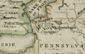 Darlington map of the Niagra region 1680.png 782 × 497; 956 KB
-
 Claude Bernou Carte de lAmerique septentrionale.jpg 3,841 × 3,641; 5.86 MB
-
 Fond de la baie d'Hudson avec les fort anglais pris par les Français en 1686.jpg 4,568 × 4,449; 5.38 MB
-
 Moose Factory rebaptisé Fort St-Louis après sa capture par les Français en 1686.jpg 1,743 × 1,243; 645 KB


