Category:1680s maps of England
Media in category "1680s maps of England"
The following 9 files are in this category, out of 9 total.
-
 England. NYPL1503435.tiff 5,248 × 6,299; 94.6 MB
-

-
 Map of ancient Britain, 1685.jpg 624 × 900; 413 KB
-
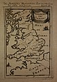
 Map of England, 1685.jpg 671 × 900; 400 KB
-
 Map of Saxon England, 1685.jpg 630 × 900; 389 KB
-

-

-

-
 UBBasel Map Großbritannien 1685-1686 Kartenslg Mappe 238-4.tif 3,757 × 3,717, 2 pages; 39.98 MB
.jpg)


.jpg)
.jpg)
.jpg)