Category:1690s maps of Palestine
Media in category "1690s maps of Palestine"
The following 9 files are in this category, out of 9 total.
-
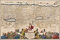 Ca. 1690 map of the Holy Land by Daniel Stoopendaal.jpg 11,144 × 7,500; 16.8 MB
-
 1695 Eretz Israel map in Amsterdam Haggada by Abraham Bar-Jacob.jpg 1,454 × 809; 391 KB
-
 1695 map of Palestine in Hebrew.jpg 11,935 × 6,756; 13.08 MB
-

-

-
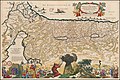 Ca. 1690 map of Moses' travel from Egypt to Canaan.jpg 11,183 × 7,495; 19.13 MB
-
-
 Kaart van Juda en Israël, objectnr A 16204.jpg 7,283 × 6,288; 35.03 MB
-
 Sea of Galilee. A map of Canaan (8343807206) (cropped).jpg 662 × 848; 707 KB


_(cropped).jpg)