Category:16th-century maps of Iceland
Countries of Europe: Albania · Armenia‡ · Austria · Azerbaijan‡ · Belarus · Belgium · Bosnia and Herzegovina · Bulgaria · Croatia · Cyprus‡ · Czech Republic · Denmark · Estonia · Finland · France‡ · Georgia‡ · Germany · Greece · Hungary · Iceland · Republic of Ireland · Italy · Latvia · Lithuania · Moldova · Netherlands‡ · Norway · Poland · Portugal‡ · Romania · Russia‡ · Serbia · Slovakia · Slovenia · Spain‡ · Sweden · Switzerland · Turkey‡ · Ukraine
Specific status: Isle of Man – Limited recognition: Abkhazia‡
‡: partly located in Europe
Specific status: Isle of Man – Limited recognition: Abkhazia‡
‡: partly located in Europe
Subcategories
This category has the following 4 subcategories, out of 4 total.
1
I
M
Media in category "16th-century maps of Iceland"
The following 48 files are in this category, out of 48 total.
-
 Sebastian Münster - Map 18 Northern Europe - 1545.jpg 4,222 × 3,181; 1.93 MB
-
 1560s map of Iceland by Giovanni Francesco Camocio.jpg 4,634 × 6,224; 8.48 MB
-
 Si0050x1024.jpg 1,024 × 749; 294 KB
-
 NE Atlantic, Spain to Iceland RMG C4567 5.jpg 1,579 × 1,198; 760 KB
-

-
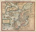
 Abraham Ortelius - Septentrionalivm regionvm descriptio - 1570.jpg 6,382 × 4,564; 3.61 MB
-
 Carte - Islande - 1588 - 001.jpg 4,631 × 3,881; 2.18 MB
-
 Carte - Islande - 1588 - 002.jpg 4,449 × 3,932; 1.87 MB
-
 Carte - Islande - 1588 - 003.jpg 4,593 × 3,895; 1.61 MB
-
 Carte - Islande - 1588 - 004.jpg 4,548 × 4,000; 1.54 MB
-
 De Islandia Insvla - 1570.jpg 2,342 × 3,081; 1.09 MB
-
 Fernando Bertelli - De Islanda Insvla - 1566.jpg 2,325 × 4,045; 1.46 MB
-
 Giacomo Gastaldi-Vincenzo Valgrisi - Island - 1561.jpg 3,576 × 2,700; 985 KB
-
 Giovanni Camocio - De Islandia Insvla - 1571.jpg 2,295 × 3,124; 922 KB
-
 Greenland Mercator 1569.jpg 993 × 1,500; 509 KB
-
 Hieronymus Gourmont - Island - 1548.jpg 7,202 × 5,042; 4.36 MB
-

-
 Island118x1024.jpg 1,024 × 1,383; 292 KB
-
 Island11x1024.jpg 1,024 × 538; 90 KB
-
 Island12x1024.jpg 1,024 × 1,647; 273 KB
-
 Island13x1024.jpg 1,024 × 792; 112 KB
-
 Island15x1024.jpg 1,024 × 955; 155 KB
-
 Island16x1024.jpg 1,024 × 784; 114 KB
-
 Island18x1024.jpg 1,024 × 798; 167 KB
-
 Island19x1024.jpg 1,024 × 786; 130 KB
-
 Island1x1024.jpg 1,024 × 1,411; 377 KB
-
 Island20x1024.jpg 2,995 × 2,221; 4.96 MB
-
 Lucas 1898 Figure 8 Fixlanda Prunes 1553 annalsofvoyageso00luca 0140.jpg 2,997 × 4,116; 949 KB
-
 Midnightlands.jpg 1,024 × 799; 147 KB
-
 Nicolo Zeno-Girolamo Ruscelli - Septentrionalivm partivm nova tabvla - 1561.jpg 3,349 × 2,507; 1.12 MB
-
 Oceano Atlántico no Boke of Idrography de Jean Rotz (1542).jpg 8,668 × 6,712; 22.54 MB
-
 Olaus Magnus Scandza.gif 1,600 × 2,483; 1.53 MB
-
 Ortelius, Abraham Septentrionalivm regionvm descrip.jpg 6,044 × 4,506; 7.47 MB
-
 Philip Galle - Septentrionalium regionum descriptio - 1577.jpg 1,429 × 1,067; 275 KB
-
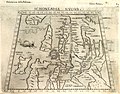
 Schonladia nuova.tif 4,957 × 3,730; 52.9 MB
-
 Sebastian Münster - Midnight Lands - 1544.jpg 4,713 × 3,534; 2.07 MB
-
 Si0044x1024.jpg 1,024 × 900; 265 KB
-
 Si0045x1024.jpg 1,024 × 868; 274 KB
-
 Si0046x1024.jpg 1,024 × 905; 319 KB
-
 Si0077x1024.jpg 1,024 × 783; 263 KB
-
 Si0099x1024.jpg 1,024 × 1,639; 481 KB
-
 Si0132x1024.jpg 988 × 1,544; 305 KB
-
 Si0133x1024.jpg 1,024 × 806; 245 KB
-
 Si0134x1024.jpg 1,024 × 764; 276 KB
-
 Skálholt-Karte, einschließlich Legende.jpg 1,619 × 2,041; 637 KB
-
 Skálholt-Karte.png 341 × 398; 290 KB
-
 Thulé gravure.jpg 2,200 × 1,823; 5.34 MB
-
 Thyle - 1576.jpg 1,143 × 1,761; 284 KB


_68.jpg)


.jpg)


.jpg)


