Category:16th-century maps of Sri Lanka
Countries of Asia: Afghanistan · Armenia‡ · Azerbaijan‡ · Cambodia · People's Republic of China · Cyprus‡ · Egypt‡ · Georgia‡ · India · Indonesia‡ · Iran · Iraq · Japan · Jordan · Malaysia · Maldives · Myanmar · Pakistan · Philippines · Russia‡ · Saudi Arabia · Sri Lanka · Thailand · Turkey‡ · Uzbekistan · Vietnam
Limited recognition: Abkhazia‡ · Taiwan · State of Palestine
‡: partly located in Asia
Limited recognition: Abkhazia‡ · Taiwan · State of Palestine
‡: partly located in Asia
Media in category "16th-century maps of Sri Lanka"
The following 15 files are in this category, out of 15 total.
-
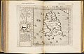
 *Tabula Asiae XII (Sri Lanka) north.jpg 800 × 600; 129 KB
-
 *Tabula Asiae XII (Sri Lanka) south.jpg 800 × 600; 116 KB
-

-
 Duodecima Asiae tabula (7537889496).jpg 2,000 × 1,498; 2.63 MB
-
 1528 - Bordone - BNF - Taprobana.jpg 690 × 905; 114 KB
-
 Tabula Asiae XII, Taprobana insula.jpg 3,774 × 2,781; 4.22 MB
-
 UBBasel Map Taprobane 1550 Kartenslg Mappe 251-96.tiff 7,274 × 4,719, 2 pages; 181.25 MB
-
 Egnazio Danti - Indian subcontinent and island of Sri Lanka - Google Art Project.jpg 5,022 × 9,250; 24.92 MB
-
 "Deliniantur in hac tabio , Orae maritimae Abexiae..." (26097240890).jpg 4,167 × 5,593; 2.96 MB
-
 Asia XII ceylon.jpg 1,600 × 1,200; 387 KB
-
-
 Map of Taprobana (1574).jpg 1,212 × 1,038; 389 KB
-
 Map of the Deccan and the south (c.1588).jpg 800 × 634; 158 KB
-
 Ruscelli-map-1562 Tamil vanni country.jpg 1,950 × 1,473; 3.09 MB
-
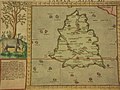 Tabula Asiae XII (Sri Lanka).jpg 800 × 600; 144 KB
_north.jpg)
_south.jpg)
_(14779417961).jpg)
.jpg)


.jpg)

_28.jpg)
.jpg)
.jpg)

.jpg)