Category:1710s maps of Baden-Württemberg
Federal states of Germany:
Subcategories
This category has only the following subcategory.
+
Media in category "1710s maps of Baden-Württemberg"
The following 10 files are in this category, out of 10 total.
-

-

-
 Alexanderschanze, von Prälat Johann Mayer.jpg 1,336 × 682; 1.09 MB
-
 Bodenehr Mannheim c1715.jpg 4,791 × 2,998; 7.98 MB
-
 Ducatus Wurtenbergici 1 (Detail).jpg 1,056 × 1,056; 1.16 MB
-
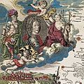
 Ducatus Wurtenbergici 1.jpg 3,350 × 4,010; 8.16 MB
-
 Ducatus Wurtenbergici 2 cropped.jpg 338 × 674; 376 KB
-
 Ducatus Wurtenbergici 2.jpg 3,357 × 4,023; 7.75 MB
-
 Ducatus Wurtenbergici in totum.jpg 6,706 × 4,073; 15.96 MB
-
 Map - Special Collections University of Amsterdam - OTM- HB-KZL 32.01.26.tif 7,884 × 6,738; 151.99 MB
.jpg)
.jpg)


.jpg)


