Category:1710s maps of Indonesia
Media in category "1710s maps of Indonesia"
The following 6 files are in this category, out of 6 total.
-
 AMH-5542-NA Chart showing the Halmaheira to Nova Guinea.jpg 1,672 × 2,400; 732 KB
-
 New Guinea, New Britain, and New Holland &c.png 2,106 × 1,517; 4.97 MB
-
 Map of Western Java (1718).jpg 1,280 × 1,098; 1.57 MB
-
 1718 Chatelain Map of Java - Geographicus - Java-chatelain-1718.jpg 6,000 × 2,721; 5.01 MB
-
 AMH-4673-NA Map of the fort at Passarouan and environs.jpg 1,528 × 2,400; 559 KB
-
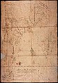
 Map of the Moluccas, 1718.jpg 768 × 1,024; 120 KB


.jpg)


