Category:1711 maps of Europe
Temperate regions: North America · South America · Africa · Europe · Asia · – Polar regions: – Other regions:
English: 1711 maps of Europe
Español: Mapas de Europa en 1711
Suomi: Euroopan kartat vuodelta 1711
Română: Hărți ale Europei din 1711
Subcategories
This category has the following 6 subcategories, out of 6 total.
.
F
- 1711 maps of France (2 F)
R
- 1711 maps of Russia (2 F)
S
- 1711 maps of Spain (empty)
T
- 1711 maps of Turkey (1 F)
Media in category "1711 maps of Europe"
The following 3 files are in this category, out of 3 total.
-
 Fricx-Harrewijn, Plan de la ville de Brusselles, 1711.png 9,338 × 7,969; 162.6 MB
-
 Postkurse 1711.jpg 1,372 × 1,128; 509 KB
-
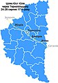 Шлях Юст Юля через Тернопільщину 24-28 серпня 1711 року.jpg 559 × 800; 155 KB


