Category:1717 maps of South America
Temperate regions: North America · South America · Africa · Europe · Asia · Oceania – Polar regions: – Other regions:
| 1711 1716 1717 1718 1719 → |
Media in category "1717 maps of South America"
The following 11 files are in this category, out of 11 total.
-
 Samuel Fritz Cours du fleuve Maragnon 1717.jpg 1,414 × 873; 828 KB
-
 Samuel Fritz Strom Maragnon 1728.jpg 1,307 × 841; 478 KB
-

-
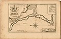
 A map of the straits of Magellan etc - (H. Moll) - btv1b8596641n.jpg 2,112 × 1,538; 576 KB
-

-

-
 Frezier Voyage Ilo.jpg 1,828 × 1,193; 538 KB
-
 Frezier Voyage Pisco.jpg 1,748 × 1,191; 626 KB
-
 Frezier Voyage Valparaisso.jpg 1,820 × 1,210; 671 KB
-
 Part of Peru - the Bay of Guyaquil - by H. Moll - btv1b8596524s.jpg 3,280 × 3,620; 2.17 MB
-
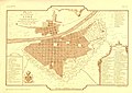 Planche XXVIII.jpg 4,960 × 3,508; 936 KB


_-_btv1b8596641n.jpg)


