Category:1720s maps of the Americas
Subcategories
This category has the following 2 subcategories, out of 2 total.
N
S
Media in category "1720s maps of the Americas"
The following 18 files are in this category, out of 18 total.
-

-

-
 A new map of America from the latest observations (4072635516).jpg 2,000 × 1,707; 3.76 MB
-
 America - by H. Moll, geographer, 1726. NYPL433734.tiff 2,320 × 2,946; 19.56 MB
-
 America. NYPL465060.tiff 4,592 × 4,185; 54.99 MB
-
 Carte d'Amérique dressée pour l'usage du Roy - par Guillaume Delisle... - btv1b530886445.jpg 9,360 × 6,848; 8.39 MB
-
 Carte d'Amérique dressée pour l'usage du Roy - par Guillaume Delisle... - btv1b5973091b.jpg 7,530 × 6,086; 5.16 MB
-
 Carte d'Amérique dressée pour l'usage du Roy - par Guillaume Delisle... - btv1b84683697.jpg 10,258 × 8,220; 12.9 MB
-
 Carte d'Amérique dressée pour l'usage du Roy - par Guillaume Delisle... - btv1b8468370w.jpg 10,366 × 8,412; 12.55 MB
-
 Carte d'Amérique dressée pour l'usage du Roy - par Guillaume Delisle... - btv1b8468564v.jpg 10,823 × 8,571; 13.77 MB
-
 Carte d'Amérique dressée pour l'usage du Roy - par Guillaume Delisle... - btv1b84694123.jpg 10,440 × 8,086; 12.17 MB
-
 Carte dAmerique (5384787467).jpg 2,000 × 1,436; 2.62 MB
-

-

-

-
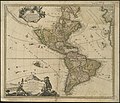
 LAmerique, meridionale, et septentrionale (4072634694).jpg 2,000 × 1,676; 3.73 MB
-
 America (NYPL b15369858-433734).jpg 2,320 × 2,946; 2.13 MB
-

.jpg)
.jpg)


.jpg)

.jpg)
.jpg)
.jpg)
.jpg)