Category:1724 maps
| ← 1720 1721 1722 1723 1724 1725 1726 1727 1728 1729 → |
Deutsch: Karten mit Bezug zum Jahr 1724
English: Maps related to the year 1724
Español: Mapas relativos al año 1724
Français : Cartes concernant l’an 1724
Русский: Карты 1724 года
Subcategories
This category has the following 4 subcategories, out of 4 total.
A
E
O
Media in category "1724 maps"
The following 74 files are in this category, out of 74 total.
-
 (Map of the several nations of Indians to the Northwest of South Carolina). LOC 2005625337.jpg 14,154 × 9,732; 13.29 MB
-
 (Map of the several nations of Indians to the Northwest of South Carolina). LOC 2005625337.tif 14,154 × 9,732; 394.1 MB
-
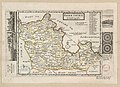
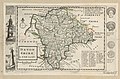
 A new description of England and Wales, with the adjacent islands Fleuron T145692-26.png 2,394 × 2,220; 165 KB
-
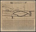
 A Plan of ye Late Breach of Dagenheim.jpg 335 × 785; 60 KB
-
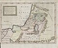
 Antoine Augustin Calmet, Carte de la Terre Promise (FL4538619 2368437).jpg 1,800 × 3,488; 2.83 MB
-
 Baode Zhou cheng tu. LOC gm71005156.jpg 5,392 × 5,872; 4.01 MB
-
 Baode Zhou cheng tu. LOC gm71005156.tif 5,392 × 5,872; 90.59 MB
-
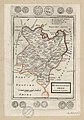
 Bedford Shire - By H. Moll Geographer - btv1b53056944p.jpg 4,024 × 2,952; 1.75 MB
-
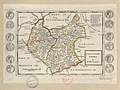
 Berk Shire - By H. Moll Geographer - btv1b53056293n.jpg 4,000 × 2,912; 1.88 MB
-
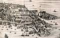 Venice arsenale 2 1724.JPG 2,639 × 1,678; 1.38 MB
-
 Bodleian Libraries, Buckinghamshire by Herman Moll.jpg 672 × 1,000; 142 KB
-
 Buckingham Shire - By H. Moll Geographer - btv1b530563681.jpg 3,048 × 4,296; 1.83 MB
-
 Cambridge-Shire - By H. Moll Geographer - btv1b530568644.jpg 3,048 × 4,304; 1.95 MB
-
 Campegius Vitringa, Conspectus Moabitidis ad intelligentiam (FL6881466 2627505).jpg 5,328 × 4,720; 38.36 MB
-
 Carta-ofver-grønlands vesterside-hans-egede-1724.JPG 968 × 763; 177 KB
-
 Carte de l'embouchure de la riviere de Charente RMG F1993.tiff 9,213 × 3,868; 101.96 MB
-
 Carte de la rade et baye de Marseille RMG F1989.tiff 7,221 × 4,949; 102.24 MB
-
 Carte des baye et rades de Toulon RMG F1992.tiff 7,903 × 4,545; 102.77 MB
-
 Carte des ports de l'Orient et Port Louis avec l'Isle de Grouais RMG F1994.tiff 8,682 × 4,110; 102.09 MB
-
 Carte Louisiane Benard de la Harpe 1724.jpg 1,022 × 1,386; 498 KB
-

-
 Carte particuliere des environs de la Rade de Brest RMG F1983.tiff 7,830 × 4,564; 102.24 MB
-
 CatawbaMap1721.jpg 2,048 × 1,408; 1.11 MB
-
 Cornwal - By H. Moll Geographer - btv1b53056815h.jpg 4,080 × 2,936; 1.96 MB
-
 Dagenham Breach 1724.jpg 471 × 347; 38 KB
-
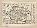
 Devon Shire - By H. Moll Geographer - btv1b53056863p.jpg 4,056 × 2,656; 1.58 MB
-
 Dorset Shire - By H. Moll Geographer - btv1b53056183v.jpg 4,000 × 2,600; 1.77 MB
-
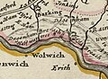
 Essex (5384794493).jpg 2,000 × 1,378; 2.9 MB
-
 Essex - By H. Moll Geographer - btv1b53056597k.jpg 4,080 × 2,976; 2.16 MB
-
 KAART Eyland Formosa.gif 621 × 788; 366 KB
-
 Kaart Van Het Eyland Formosa (small, color).jpg 874 × 704; 207 KB
-
 Kaart van het Eyland Formosa en de Eylanden van Piscadores.jpg 4,522 × 3,644; 11.35 MB
-
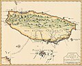
 Kaart van het Eyland Formosa.jpg 2,400 × 1,931; 683 KB
-
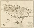
 Old Taiwan map.jpg 1,744 × 1,236; 1,021 KB
-

-
 Glocester Shire - By H. Moll Geographer - btv1b53056595p.jpg 4,128 × 2,784; 1.91 MB
-
 Hamp Shire - By H. Moll Geographer - btv1b530564887.jpg 4,296 × 2,920; 2.04 MB
-

-
 Hertford Shire - By H. Moll Geographer - btv1b530569867.jpg 4,112 × 3,032; 2.03 MB
-
 Huntingdon-Shire - By H. Moll Geographer - btv1b530567997.jpg 3,016 × 4,304; 1.88 MB
-
 Indians NW of South Carolina.jpg 1,770 × 1,217; 294 KB
-
 Isle de S. Domingue et débouquemens circonvoisins LOC 00561828.jpg 7,434 × 5,179; 6.3 MB
-
 Isle de S. Domingue et débouquemens circonvoisins LOC 00561828.tif 7,434 × 5,179; 110.15 MB
-
-
 Kent - By Herman Moll Geographer - btv1b53056577r.jpg 3,968 × 2,928; 2.18 MB
-

-
 Le royaume de France. LOC 2002624014.jpg 10,333 × 6,085; 11.59 MB
-
 Le royaume de France. LOC 2002624014.tif 10,333 × 6,085; 179.89 MB
-
 Leicester-Shire - By H. Moll Geographer - btv1b53056770c.jpg 4,128 × 3,088; 1.96 MB
-
 Lincoln Shire - By H. Moll Geographer - btv1b530562943.jpg 2,976 × 4,408; 2.19 MB
-
 Norfolk - By H. Moll Geographer - btv1b53056714p.jpg 4,168 × 3,120; 1.88 MB
-
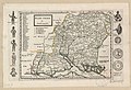
 Northampton Shire - By H. Moll Geographer - btv1b53056209m.jpg 4,128 × 2,976; 1.89 MB
-
 Nottingham Shire - By H. Moll Geographer - btv1b53056513g.jpg 2,992 × 4,352; 1.92 MB
-
 Orientaliora Indiarum Orientalium cum insulis adjacentibus a promontorio C. Comorin ad Japan.png 6,557 × 5,338; 63.52 MB
-
 Oxford Shire - By H. Moll Geographer - btv1b53056541t.jpg 2,936 × 4,096; 1.83 MB
-
 Patriarchatus Hierosolymitani geographica nova descriptio (FL37119322 3897060).jpg 3,387 × 2,836; 5.25 MB
-
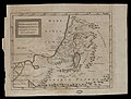 Patriarchatus Hierosolymitani geographica nova descriptio (FL50290347 4048382).jpg 8,248 × 6,246; 64.94 MB
-
 Plan de Bayonne RMG F1988.tiff 6,931 × 5,120; 101.53 MB
-
 Plan de Brest RMG F1984.tiff 7,058 × 5,041; 101.79 MB
-
 Plan de Dunkerque RMG F1978.tiff 8,328 × 4,241; 101.05 MB
-
 Plan de la ville et chateau de St Malo RMG F1982.tiff 6,855 × 5,137; 100.75 MB
-
 Plan de la ville et citadelle de Calais et Fort de Nieulay RMG F1979.tiff 7,012 × 5,013; 100.57 MB
-
 Plan de la ville et citadelle du Havre RMG F1980.tiff 7,024 × 5,013; 100.74 MB
-
 Plan de la ville et citadelle du Port-Louis RMG F1986.tiff 6,932 × 5,111; 101.36 MB
-
 Plan de Rochefort RMG F1987.tiff 7,126 × 4,955; 101.02 MB
-
 Plan de Toulon et des environs RMG F1991.tiff 6,043 × 4,186; 72.37 MB
-
 Plan du port de l'Orient RMG F1985.tiff 6,922 × 5,180; 102.58 MB
-

-
 Rutland Shire - By H. Moll Geographer - btv1b530564959.jpg 4,112 × 3,104; 1.77 MB
-
 Somerset Shire - By H. Moll Geographer - btv1b530568661.jpg 4,192 × 3,160; 2.17 MB
-
 Suffolk - By H. Moll Geographer - btv1b53056965z.jpg 4,192 × 3,032; 2 MB
-
 Tabula Indiae orientalis et regnorum adjacentium.png 7,855 × 5,984; 72.79 MB
-
 The Isle of Wight - By H. Moll Geographer - btv1b53056365p.jpg 2,840 × 2,528; 1.11 MB
-
 Wilt Shire - By Her. Moll Geographer - btv1b530570005.jpg 3,016 × 4,304; 2.22 MB
._LOC_2005625337.jpg)


.jpg)


.jpg)


.jpg)


.jpg)


.jpg)


.jpg)
.jpg)


