Category:1736 maps of Africa
Media in category "1736 maps of Africa"
The following 13 files are in this category, out of 13 total.
-
 Negroland and Guinea with the European Settlements, 1736.jpg 1,200 × 894; 1.55 MB
-
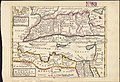
 1736 Cartagena detail West Part of Barbary map by Herman Moll BPL 14639.png 1,251 × 474; 1.22 MB
-
 1736 Jaffa detail East Part of Barbary map by Herman Moll BPL 14639.png 1,260 × 464; 1.11 MB
-
 1736 Lagos detail West Part of Barbary map by Herman Moll BPL 14639.png 1,251 × 474; 1.22 MB
-
 1736 Malaga detail West Part of Barbary map by Herman Moll BPL 14639.png 1,251 × 474; 1.22 MB
-
 1736 Map of Guinea Coast.jpg 1,200 × 894; 435 KB
-
 1736 Oran detail West Part of Barbary map by Herman Moll BPL 14639.png 1,245 × 473; 1.21 MB
-
 1736 Palermo detail West Part of Barbary map by Herman Moll BPL 14639.png 1,245 × 473; 1.21 MB
-
 1736 Tripoli detail East Part of Barbary map by Herman Moll BPL 14639.png 1,260 × 464; 1.11 MB
-

-
 Map of Africa ... NYPL1630434.tiff 6,876 × 4,812; 94.67 MB
-
 Map of Africa .. (NYPL b15369994-1630434).jpg 6,319 × 3,967; 7.99 MB
-


.jpg)
.jpg)
.jpg)