Category:1740 maps
| ← · 1740 · 1741 · 1742 · 1743 · 1744 · 1745 · 1746 · 1747 · 1748 · 1749 · → |
Deutsch: Karten mit Bezug zum Jahr 1740
English: Maps related to the year 1740
Español: Mapas relativos al año 1740
Français : Cartes concernant l’an 1740
Русский: Карты 1740 года
Subcategories
This category has the following 7 subcategories, out of 7 total.
A
- 1740 maps of Africa (3 F)
E
N
- 1740 maps of North America (1 F)
S
- 1740 maps of South America (4 F)
Media in category "1740 maps"
The following 83 files are in this category, out of 83 total.
-
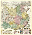 1740 map of China, published by Homann Heirs.jpg 12,726 × 14,291; 45.99 MB
-

-

-
 1740 Seutter Map of Swabia and Wirtenberg, Germany - Suevicus-Seutter-1740 Reprint.jpg 6,802 × 5,911; 6.14 MB
-

-

-

-

-

-

-
 Ca. 1740 map of China, published by Homannsche Erben.jpg 12,863 × 14,455; 32.53 MB
-
 Carl von Frauendorff, Verus Chersonesi Tauricae Seu Crimeae Conspectus (FL147394463 2607436).jpg 16,615 × 12,624; 218.22 MB
-
 Carte de la coste d'Arabie, Mer Rouge, et Golfe de Perse (FL35865376 2492245).jpg 8,823 × 5,783; 67.03 MB
-
 Carte de la coste d'Arabie, Mer Rouge, et Golfe de Perse (FL35868131 2725034).jpg 7,127 × 5,980; 55.89 MB
-
 Carte du Lac Champlain depuis le Fort Chambly jusqu'a celuyde St. Fréderic. LOC 2008626932.jpg 12,643 × 5,812; 8.09 MB
-
 Carte du Lac Champlain depuis le Fort Chambly jusqu'a celuyde St. Fréderic. LOC 2008626932.tif 12,643 × 5,812; 210.23 MB
-
-
 Das Land Appenzell (Gabriel Walser).png 1,070 × 630; 1.42 MB
-

-
 E-Kaempfer-Nagasaki-Kaido.jpg 4,233 × 3,417; 10.85 MB
-

-
 Environs de Paris levés géométriquement par M. l'Abbé de La Grive.png 1,422 × 1,032; 1.71 MB
-

-
 Etats du Grand-Seigneur en Asie - Empire de Perse, Pays des Usbecs, Arabie et Egypte LOC 2013593001.tif 10,523 × 8,285; 249.43 MB
-
 Gallia Vetus (FL33133783 2584906).jpg 12,123 × 9,437; 145.45 MB
-
 Gallia Vetus (FL33133795 2585024).jpg 11,788 × 9,760; 152.85 MB
-
 Geographic Map of Brazil WDL1195.png 1,222 × 1,024; 2.39 MB
-
 Georg Balthasar Probst, Ierusalem (FL6881037 2368160).jpg 4,100 × 1,462; 3.59 MB
-
 Georg Balthasar Probst, Ierusalem, hodierna (FL6881022 2368159).jpg 4,100 × 1,461; 3.72 MB
-

-
 Grundriss des unmittelbaren Reichsstift und Gotteshauses Weingarten HStAS N 34 Nr 77.jpg 1,499 × 2,201; 1.71 MB
-
 Guillaume Delisle, Carte de la Turquie de l'Arabie et de la Perse (FL36010551 2715974).jpg 15,578 × 12,778; 279.34 MB
-
 Herman Moll Map of France.jpg 760 × 485; 118 KB
-
 Isaak Tirion, Kaart van't Joodsche Land ten tyde van onzen zaligmaaker (FL36556329 3899766).jpg 10,553 × 8,392; 117.96 MB
-

-
 Ivan Grimmel, Ладожское озеро и Финскіий заливъ съ прилѣжащими мѣстами (FL147457845 2607285).jpg 19,077 × 13,184; 266.88 MB
-

-
 Johann Jacob Schmidt, Facies vrbis Hierosolymae olim in IV montibus (FL45593348 3931760).jpg 2,888 × 2,258; 3.75 MB
-

-

-
 Joseph Goupy, Veduta della citta di Malta (FL13722366 2471658).jpg 4,110 × 3,430; 20.38 MB
-
 Joseph Goupy, Veduta della citta di Malta dalla parte dei Gesuiti (FL13722363 2471699).jpg 4,110 × 3,408; 21.54 MB
-
 Joseph Goupy, Veu del porto dell entrata e della citta di Malta (FL13722360 2471695).jpg 4,058 × 3,398; 21.02 MB
-

-

-
 L'expedition d'Alexandre - pour l'Histoire Ancienne de Mr. Rollin LOC 2013593014.jpg 6,218 × 3,919; 3.06 MB
-
 L'expedition d'Alexandre - pour l'Histoire Ancienne de Mr. Rollin LOC 2013593014.tif 6,218 × 3,919; 69.72 MB
-
 Map of Cartagena2.jpg 949 × 536; 330 KB
-
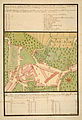
 Map reference detailing quality and extent of land (31396287663).jpg 3,253 × 4,020; 8.51 MB
-
 Map viewed from right hand side (31365190024).jpg 4,608 × 3,456; 5.74 MB
-

-
 Matthäus Seuttetre, Barcino metropolis Hispanici principatus Cataloniae (FL167449107 2397178).jpg 14,432 × 12,445; 207.88 MB
-
 Matthäus Seuttetre, Constantinopolis (FL33122147 2369936).jpg 14,061 × 8,678; 184.2 MB
-
 Matthäus Seuttetre, Imperium Turcicum per Europam Asiam et Africam (FL36010543 2715960).jpg 12,716 × 15,581; 284.12 MB
-

-
 Natolie ou Turquie d'Asie (FL35866737 2645229).jpg 9,995 × 6,422; 90.95 MB
-

-

-
 Nicolaes Visscher II, Austriæ Archiducatus Pars Inferior (FL37099024 2526782).jpg 21,603 × 12,493; 399.15 MB
-

-

-
 Plan de l'Ancienne Jerusalem (FL13735712 3607383).jpg 5,077 × 5,260; 33.55 MB
-
 Plan der Residenzstadt Meersburg Pozzi 1740.jpg 3,333 × 5,163; 4.54 MB
-

-

-

-
 Plano de la agvada nveva de Pverto Rico es copia del ... sesaco el anno 1740. LOC 73691520.tif 5,660 × 7,939; 128.56 MB
-
 Platte grond van Jerusalem.volgens Josefus en de Rabbynen (FL36558882 3901677).jpg 8,391 × 7,249; 86.02 MB
-
 Prag (FL39695549 2369958).jpg 6,257 × 1,688; 15.32 MB
-

-
 Reinier Ottens, Insula Ceilon et Madura, exactissimè delineate et nuperrimè (FL35472086 2514044).jpg 14,755 × 12,144; 248.33 MB
-

-
 South Carolina RMG F0286.tiff 7,217 × 5,909; 122.01 MB
-
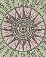
 Tabula anemographica seu pyxis nautica vulgo compass charte (34333419784).jpg 2,000 × 1,733; 4.06 MB
-
 Tabula geographica ad Florum (FL33132637 2522057).jpg 16,554 × 9,631; 204.51 MB
-

-

-

-
 The seat of war in the West Indies 1740.jpg 7,522 × 6,504; 11.88 MB
-
 The travels of the Children of Israel out of Ægypt (FL13733989 3561251).jpg 4,512 × 3,723; 23.44 MB
-
-

-
 William Henry Toms, Syria (FL13729074 2515284).jpg 5,836 × 3,959; 31.2 MB


.jpg)


.jpg)
.jpg)
.jpg)

_(cropped).jpg)
.png)


.jpg)
.jpg)

.jpg)

.jpg)

.jpg)
.jpg)
.jpg)
.jpg)
.jpg)
.jpg)
.jpg)
.jpg)
.jpg)


.jpg)
.jpg)
,_seg%C3%BAn_el_Padre_Juan_Magnin_Misionero_de_la_Compa%C3%B1ia_de_Jes%C3%BAs_-_AHG.jpg)
.jpg)
.jpg)
.jpg)
.jpg)

.jpg)

.jpg)


.jpg)
.jpg)
.jpg)
.jpg)
.jpg)
.jpg)


.jpg)
_LOC_2002622163.jpg)
.jpg)
.jpg)
.jpg)
.jpg)
.jpg)
.jpg)