Category:1740s maps of Hamburg
|
Federal states of Germany: |
Media in category "1740s maps of Hamburg"
The following 4 files are in this category, out of 4 total.
-
 A new Plan of Hambourg, by Peter Martel, engineer, 1746 - btv1b8440092d.jpg 9,094 × 6,317; 10.59 MB
-

-
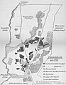 Langenhorn 1740.jpg 1,449 × 1,860; 1.29 MB
-
 PPN669644560 Hamburgum (1740).jpg 5,772 × 3,955; 19.64 MB

..._Plan_de_la_ville_imp%C3%A9riale_de_Hamburg..._-_btv1b8490748s.jpg)

.jpg)