Category:1757 maps
| ← · 1750 · 1751 · 1752 · 1753 · 1754 · 1755 · 1756 · 1757 · 1758 · 1759 · → |
Deutsch: Karten mit Bezug zum Jahr 1757
English: Maps related to the year 1757
Español: Mapas relativos al año 1757
Français : Cartes concernant l’an 1757
Русский: Карты 1757 года
Subcategories
This category has the following 7 subcategories, out of 7 total.
Media in category "1757 maps"
The following 67 files are in this category, out of 67 total.
-
 (Ming shi san ling tu). LOC gm71005138.tif 15,826 × 8,021; 363.18 MB
-

-
 1757 map Post Office in Cope Street Dublin.jpg 2,236 × 1,596; 797 KB
-
 1757.Casernenstrasse 1 5.3068.tif 1,362 × 826; 4.31 MB
-
 1757.Gensdarmenmarkt.3068.tif 1,362 × 826; 4.31 MB
-
 1757.Letztestrasse 1 31.3068.tif 1,362 × 826; 4.31 MB
-
 1757.Lustgarten Umgebung.3068.tif 1,362 × 826; 4.31 MB
-
 1757.Platz am Opernhaus 1 2.3068.tif 1,362 × 826; 4.31 MB
-
 1757.Unter den Linden 1 22.3068.tif 1,362 × 826; 4.31 MB
-

-
 A plan of the city, and fortifications, of Louisburg; LOC 77694213.jpg 7,590 × 4,710; 6.31 MB
-
 A plan of the city, and fortifications, of Louisburg; LOC 77694213.tif 7,590 × 4,710; 102.28 MB
-
 A. F. de Palmeus, Nouvelle Carte de la Perse (FL33249994 2517400).jpg 13,016 × 9,620; 191.93 MB
-
 AMH-8029-KB Map of the island of Cayenne and environs.jpg 2,400 × 1,895; 948 KB
-
 AMH-8030-KB Map of the city of Cayenne.jpg 2,400 × 1,922; 943 KB
-
-
-

-
 Antoine Augustin Calmet, Tabula Terrae Promissae (FL200036690 2368425).jpg 4,056 × 6,240; 36.99 MB
-
 Archipelague du Mexique ou sont les isles de Cuba, Espagnole, Iamaïque, etc. LOC 74690813.jpg 16,105 × 9,769; 18.42 MB
-
 Archipelague du Mexique ou sont les isles de Cuba, Espagnole, Iamaïque, etc. LOC 74690813.tif 16,105 × 9,769; 450.12 MB
-

-

-
 Carte reduite de l'Ocean occidental. NYPL478198.tiff 6,299 × 4,600; 82.92 MB
-
 Copy of The outline directory map of Japan (14273685807).jpg 2,500 × 1,315; 1.59 MB
-

-

-

-

-
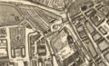
 Excerpt from St Annæ Øster Kvarter 1757 by Gedde.jpg 1,024 × 706; 170 KB
-
 GrandPre1704RaidFirst.jpg 1,200 × 922; 699 KB
-
 GrandPre1704RaidSecond.jpg 1,200 × 922; 701 KB
-
 Ile de Re in the Chart of the Road of Basque 1757.jpg 2,589 × 1,984; 621 KB
-
 Kaart van Azië, objectnr A 16217.jpg 7,397 × 5,936; 36.35 MB
-
 Karte Meissnischer Kreis Homannsche Erben 1757 (cropped).jpg 1,547 × 1,184; 827 KB
-
 Karte Thüringer Kreis Homannsche Erben 1757 (cropped).jpg 2,130 × 1,211; 1.16 MB
-
 Kwartier-zutphen-1757.jpg 2,924 × 2,448; 5.65 MB
-
 Les Isles d'Auregny et de Burhou 1757 (Alderney).jpg 804 × 585; 117 KB
-

-
 Ming shi san ling tu. LOC gm71005138.jpg 15,826 × 8,021; 20.18 MB
-
 Nantes - Détail plan Cacault couvent des Carmes - 1757.png 256 × 292; 111 KB
-

-
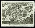
 Olomouc map 1757.jpg 640 × 604; 362 KB
-
 Overijssel 1757.jpg 2,470 × 2,240; 4.89 MB
-

-

-
 Plan de la Ville et du Port de Macao.jpg 950 × 1,180; 1.13 MB
-
 Plan du Centre-ville de Nantes détai plan Cacault 1756-1757.png 899 × 767; 1.4 MB
-

-

-
 Plan of the river of Annapolis Royal in Nova Scotia. LOC 74691492.jpg 13,037 × 2,964; 4.53 MB
-
 Plan of the river of Annapolis Royal in Nova Scotia. LOC 74691492.tif 13,037 × 2,964; 110.55 MB
-

-

-

-

-
 Robert de Vaugondy - Environs de Paris.jpg 3,459 × 2,909; 2.94 MB
-
 Salland 1757.jpg 1,796 × 1,490; 995 KB
-
 The seat of war in the circle of Westphalia (5121168754).jpg 2,000 × 1,619; 3.66 MB
-
 The shore of the Red Sea (FL13728516 2510915).jpg 3,802 × 5,158; 24.39 MB
-
-
 Thomas Shaw, A map of the kingdom of Tunis (FL13727047 2496873).jpg 6,057 × 7,568; 63.58 MB
-
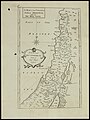
 Thomas Shaw, A plan of the city and country about Jerusalem (FL184621357 2368184).jpg 6,000 × 4,730; 12.34 MB
-

-
 Tilforladelig Kort over Eylandet St. Croix udi America - no-nb krt 00577.jpg 11,312 × 7,525; 26.61 MB
-
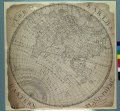 UNIVERSAL PLANISPHERE A) The Earth's Eastern Hemisphere RMG F9887.tiff 5,668 × 5,250; 85.14 MB
-
 Ville et Port de Macao.png 870 × 970; 1.86 MB


.jpg)

.jpg)


.jpg)
.jpg)
.jpg)
.jpg)

.jpg)

.jpg)


.jpg)
.jpg)

.jpg)
.jpg)


.jpg)
.jpg)
.jpg)
.jpg)
.jpg)
.jpg)

