Category:1758 maps of France
Subcategories
This category has the following 4 subcategories, out of 4 total.
B
- 1758 maps of Brest (2 F)
Media in category "1758 maps of France"
The following 10 files are in this category, out of 10 total.
-
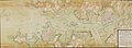
 1758 Robert de Vaugondy Post Roads of France.jpg 2,560 × 1,784; 915 KB
-

-

-
 Carte environs de Lorient et Port-Louis 1758.jpg 1,355 × 500; 439 KB
-
 Caudan Lanester Carte 1758.jpg 1,180 × 622; 518 KB
-
 Louis Denis, Paris et ses Faubourgs. Avec Versailles sur la meme Echelle, 1758 - Gallica.jpg 7,997 × 6,254; 10.23 MB
-
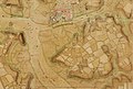 Plan Caudan Lanester 1758 2.jpg 1,321 × 892; 882 KB
-

-
 Plan Laïta Ploemeur XVIIIe.jpg 927 × 600; 328 KB
-
 Plan ville et citadelle de Port-Louis 1758.jpg 1,321 × 957; 778 KB

.jpg)
.jpg)


