Category:1770s maps of Africa
Temperate regions: North America · South America · Africa · Europe · Asia · Oceania – Polar regions: – Other regions:
Subcategories
This category has the following 15 subcategories, out of 15 total.
- 1772 maps of Africa (7 F)
- 1773 maps of Africa (3 F)
- 1774 maps of Africa (10 F)
- 1775 maps of Africa (8 F)
- 1777 maps of Africa (2 F)
- 1778 maps of Africa (13 F)
- 1779 maps of Africa (2 F)
A
- 1770s maps of Algeria (6 F)
E
- 1770s maps of Egypt (1 F)
- 1770s maps of Ethiopia (1 F)
L
S
- 1770s maps of Sudan (1 F)
Media in category "1770s maps of Africa"
The following 2 files are in this category, out of 2 total.
-
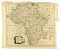 Africa (BM 1872,0113.1167).jpg 2,500 × 2,100; 1.02 MB
-
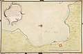 AMH-2489-NA Plan of several batteries to be built at Simon's Bay.jpg 2,400 × 1,558; 473 KB
.jpg)
