Category:1775 maps of Massachusetts
States of the United States: Massachusetts · New Jersey · New York · North Carolina · Pennsylvania · South Carolina · Virginia
| ← 1770 1772 1774 1775 1776 1777 1778 1779 → |
Media in category "1775 maps of Massachusetts"
The following 34 files are in this category, out of 34 total.
-

-

-
 A map of 100 miles round Boston. LOC 82696447.jpg 3,296 × 3,191; 1.78 MB
-
 A map of 100 miles round Boston. LOC 82696447.tif 3,296 × 3,191; 30.09 MB
-
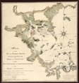
 A new plan of Boston Harbour from an actual survey. LOC 74692772.jpg 2,892 × 3,955; 1.87 MB
-
 A new plan of Boston Harbour from an actual survey. LOC 74692772.tif 2,892 × 3,955; 32.72 MB
-

-
-

-
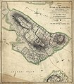
 A Plan of the battle, on Bunkers Hill fought on the 17th of June 1775, LOC gm71002452.jpg 4,059 × 5,159; 2.97 MB
-

-
-

-
-

-

-

-
 Battle of Bunker Hill. LOC gm71002450.jpg 5,628 × 4,485; 3.22 MB
-
 Battle of Bunker Hill. LOC gm71002450.tif 5,628 × 4,485; 72.22 MB
-
 Battleground of battle of bunker hill.jpg 3,840 × 4,608; 2.68 MB
-
 Boston & harbour. LOC gm71000938.jpg 3,180 × 3,956; 1.61 MB
-
 Boston & harbour. LOC gm71000938.tif 3,180 × 3,956; 35.99 MB
-
 Boston Harbor, Nachant Bay, Nantasket Road, Broad Sound, &c. (2675709026).jpg 2,000 × 1,473; 1.79 MB
-
 BostonCapeAnn1775.png 766 × 551; 707 KB
-
 Concord Retreat.jpg 1,000 × 426; 153 KB
-

-

-
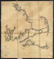
 Roxbury to Concord. Roads & distances, etc. LOC gm71005470.jpg 6,802 × 13,910; 10.27 MB
-
 Roxbury to Concord. Roads & distances, etc. LOC gm71005470.tif 6,802 × 13,910; 270.7 MB
-

-
 Thirty-miles round Boston (2674599239).jpg 2,000 × 1,955; 3.32 MB
-

-

-
 WinterHillLOCmap.jpg 1,138 × 674; 204 KB
.jpg)


.jpg)


.jpg)

