Category:1778 maps of Illinois
States of the United States: Connecticut · Illinois · Massachusetts · Missouri · New Jersey · New York · Pennsylvania · Virginia
| 1778 → |
Media in category "1778 maps of Illinois"
The following 2 files are in this category, out of 2 total.
-
 Fort Kaskaskia Illinois Country Map 1778 Cropped.jpeg 569 × 472; 117 KB
-
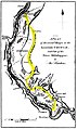 Kaskaskia Cahokia Trail Map 1778.jpg 555 × 930; 100 KB

