Category:1780 maps of Europe
Temperate regions: North America · South America · Africa · Europe · Asia · – Polar regions: – Other regions:
English: 1780 maps of Europe
Español: Mapas de Europa en 1780
Suomi: Euroopan kartat vuodelta 1780
Română: Hărți ale Europei din 1780
Subcategories
This category has the following 13 subcategories, out of 13 total.
'
.
- 1780 maps of the Habsburg Monarchy (empty)
F
G
- 1780 maps of Georgia (1 F)
- 1780 maps of Greece (2 F)
I
- 1780 maps of Italy (2 F)
N
- 1780 maps of Norway (18 F)
S
- 1780 maps of Sweden (1 F)
T
- 1780 maps of Turkey (1 F)
Media in category "1780 maps of Europe"
The following 7 files are in this category, out of 7 total.
-
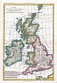 1780 Raynal and Bonne Map of British Isles - Geographicus - IslesBritanniques-bonne-1780.jpg 1,724 × 2,500; 1.23 MB
-
 1780 Raynal and Bonne Map of Europe - Geographicus - Europe-bonne-1780.jpg 2,500 × 1,719; 1.37 MB
-

-
-

-

-
 Rigobert-Bonne-Atlas-de-toutes-les-parties-connues-du-globe-terrestre MG 9983.tif 5,139 × 3,502; 51.52 MB


.jpg)
.png)
.png)
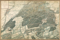
,_from_Louis-Andr%C3%A9_Dupuis,_Carte_perspective_du_chateau_royal_de_Marimont_et_de_l%27enceinte_des_chasses,_1780_(Brussels,_KBR).png)