Category:1780s maps of Schleswig-Holstein
|
Federal states of Germany: |
Subcategories
This category has only the following subcategory.
Media in category "1780s maps of Schleswig-Holstein"
The following 4 files are in this category, out of 4 total.
-

-
 Klessel‘sche Karte 1786 (DK008100) (cropped).png 996 × 1,482; 2.7 MB
-
 Klessel‘sche Karte 1786 (DK008100).jpg 7,000 × 5,099; 9.01 MB
-
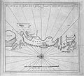 Zilt 1788.jpg 940 × 844; 296 KB

_(cropped).png)
.jpg)
