Category:1780s maps of South Carolina
States of the United States: Alabama · Alaska · Arkansas · California · Connecticut · Delaware · Florida · Georgia · Illinois · Indiana · Kentucky · Louisiana · Maryland · Massachusetts · Michigan · Mississippi · Missouri · Montana · New Hampshire · New Jersey · New York · North Carolina · North Dakota · Ohio · Pennsylvania · Rhode Island · South Carolina · Vermont · Virginia · Wisconsin – Washington, D.C.
Puerto Rico
Puerto Rico
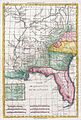
Media in category "1780s maps of South Carolina"
The following 4 files are in this category, out of 4 total.
-
-

-

-
 Vie de George Washington 1807 (125491542).jpg 4,849 × 7,434; 8.03 MB


.jpg)