Category:1780s maps of the Caucasus
Subcategories
This category has the following 5 subcategories, out of 5 total.
A
- 1780s maps of Abkhazia (1 F)
- 1780s maps of Armenia (10 F)
- 1780s maps of Azerbaijan (2 F)
G
Media in category "1780s maps of the Caucasus"
The following 26 files are in this category, out of 26 total.
-

-
 Rigobert-Bonne-Atlas-de-toutes-les-parties-connues-du-globe-terrestre MG 9999.tif 5,322 × 3,474; 52.93 MB
-
 Dido (1780-Guldenstadt-Caucasus-map).png 365 × 441; 277 KB
-

-

-
 Фрагмент «Карта представляющая Кубань. (И. Трескот, 1783)».jpg 6,000 × 3,592; 19.64 MB
-
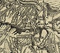
 Vladikavkaz - Zaur - Ingushi (1784).jpg 3,448 × 2,604; 4.83 MB
-
 William Faden. Composite Mediterranean. 1785.B.jpg 1,789 × 922; 418 KB
-
 William Faden. Composite Mediterranean. 1785.BA.jpg 1,303 × 915; 350 KB
-
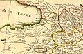
 Rigobert Bonne. Perse. 1787 (B).jpg 1,119 × 728; 259 KB
-
 Rigobert Bonne. Perse. 1787 (C).jpg 952 × 616; 186 KB
-
 Rigobert Bonne. Perse. 1787 (D).jpg 609 × 616; 138 KB
-
 Rigobert Bonne. Perse. 1787 (E).jpg 571 × 456; 102 KB
-
 Thomas Kitchin. Composite Asia, islands according to d'Anville. 1787 (A).jpg 1,207 × 1,077; 446 KB
-

-

-
 Thomas Kitchin. Composite Europe. 1787. (C).jpg 471 × 419; 86 KB
-
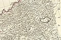
 1787-Guldenstadt-Caucasus-map.jpg 4,000 × 2,300; 7.92 MB
-

-

-

-
 Gveleti (Golet) on Güldenstädt's map.jpg 792 × 708; 410 KB
-
 Map of the Caucasus 1784.jpg 8,895 × 6,213; 25.07 MB
-
 Rigobert Bonne. Perse. 1787 (A).jpg 2,578 × 1,915; 1.36 MB
-
 Rigobert Bonne. Perse. 1787 (F).jpg 724 × 489; 112 KB
-
 William Faden. Composite Mediterranean. 1785.D.jpg 1,660 × 1,076; 583 KB

.png)


%C2%BB.jpg)
.jpg)


.jpg)
.jpg)
.jpg)
.jpg)
.jpg)
.jpg)
.jpg)
.jpg)


_on_G%C3%BCldenst%C3%A4dt%27s_map.jpg)

.jpg)
.jpg)
