Category:1786 maps of Africa
Temperate regions: North America · South America · Africa · Europe · Asia · – Polar regions: – Other regions:
| ← 1780 1781 1782 1783 1784 1785 1786 1787 1788 1789 → |
Media in category "1786 maps of Africa"
The following 9 files are in this category, out of 9 total.
-
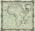
 Afrique, d'après les nouvelles études géographiques... - btv1b55000405f.jpg 9,463 × 6,640; 6.22 MB
-
 AMH-7733-NA Floor plan of Fort Goede Hoop at Berku.jpg 1,572 × 2,400; 643 KB
-
 Armenian map of Africa.jpg 418 × 310; 119 KB
-
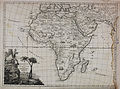
 Brion de la Tour L'Afrique Dreßée pour l'etude de la Geographie 1786 UTA.jpg 3,809 × 3,386; 10.79 MB
-
 C - btv1b53075963b.jpg 8,102 × 6,348; 8.33 MB
-

-
 Carte particulière d'Afrique du cap Mirick au Sénégal - Baugin - btv1b53153815r (1 of 2).jpg 14,998 × 6,446; 7.15 MB
-

-


_-_btv1b5966447z_(1_of_2).jpg)
.jpg)

