Category:1787 maps of Canada
Countries of North America: Belize · Canada · United States of America‡
‡: partly located in North America
‡: partly located in North America
| ← 1780 1781 1783 1784 1785 1786 1787 1788 → |
English: Maps of Canada from 1787 or related to Canada in 1787
Français : Les cartes du Canada de 1787 ou se rapportant au Canada en 1787
Media in category "1787 maps of Canada"
The following 4 files are in this category, out of 4 total.
-
-
-
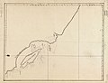
 A chart of the island of Fogo - btv1b5970455x (1 of 2).jpg 9,528 × 7,144; 6.1 MB
-
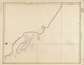
 A chart of the island of Fogo - btv1b5970456b (1 of 2).jpg 9,552 × 7,144; 6.85 MB
._LOC_91683641.jpg)
.jpg)
.jpg)