Category:1797 maps of England
Media in category "1797 maps of England"
The following 18 files are in this category, out of 18 total.
-
 Bodleian Libraries, A map of the County of Oxford 10.jpg 675 × 1,000; 246 KB
-
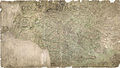
 Bodleian Libraries, A map of the County of Oxford 11.jpg 675 × 992; 114 KB
-
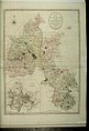 Bodleian Libraries, A map of the County of Oxford.jpg 675 × 992; 120 KB
-
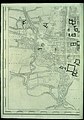
 Bodleian Libraries, A plan of the City of Oxford eastern half.jpg 672 × 960; 116 KB
-
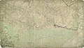
 Bodleian Libraries, A plan of the City of Oxford western half.jpg 672 × 960; 143 KB
-
 Ordnance Survey Drawings - Beaulieu (OSD 75-2).jpg 4,000 × 2,968; 4.7 MB
-
 Ordnance Survey Drawings - Christchurch Bay (OSD 75-1).jpg 4,000 × 3,458; 6.55 MB
-
 Ordnance Survey Drawings - Cranbrook (OSD 102-1).jpg 4,000 × 2,280; 4.06 MB
-
 Ordnance Survey Drawings - Dover, Kent (OSD 106E).jpg 4,000 × 2,223; 2.39 MB
-
 Ordnance Survey Drawings - Fairlight (OSD 104-3).jpg 2,368 × 4,000; 4.12 MB
-
 Ordnance Survey Drawings - Folkestone, Kent (OSD 106W).jpg 4,000 × 2,878; 3.83 MB
-
 Ordnance Survey Drawings - Goudhurst (OSD 102-2).jpg 5,714 × 3,285; 4.45 MB
-
 Ordnance Survey Drawings - Halstow Creek (OSD 114).jpg 4,000 × 2,707; 2.94 MB
-
 Ordnance Survey Drawings - Hythe, Kent (OSD 105).jpg 4,000 × 2,289; 3.19 MB
-
 Ordnance Survey Drawings - Lewes (OSD 93-3).jpg 4,000 × 2,721; 2.31 MB
-
 Ordnance Survey Drawings - Portsmouth (OSD 75-3).jpg 4,000 × 3,406; 5.43 MB
-
 Ordnance Survey Drawings - Rainham (OSD 115).jpg 4,000 × 2,673; 2.94 MB
-
 Ordnance Survey Drawings - Royal Tunbridge Wells (OSD 101).jpg 4,000 × 2,423; 4.12 MB


.jpg)
.jpg)
.jpg)
.jpg)
.jpg)
.jpg)
.jpg)
.jpg)
.jpg)
.jpg)
.jpg)
.jpg)
.jpg)